File:IMCRA mesoscale bioregions.png
Jump to navigation
Jump to search

Size of this preview: 714 × 600 pixels. Other resolutions: 286 × 240 pixels | 571 × 480 pixels | 914 × 768 pixels | 1,107 × 930 pixels.
Original file (1,107 × 930 pixels, file size: 45 KB, MIME type: image/png)
Captions
Captions
Add a one-line explanation of what this file represents
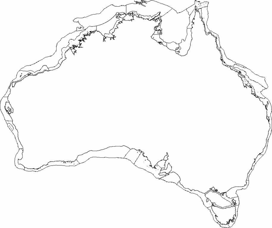
| Description | This is a map of the Integrated Marine and Coastal Biogeographic Regionalisation for Australia (IMCRA) Version 4.0 mesoscale bioregions. | ||
| Date | |||
| Source | Own work | ||
| Author | Hesperian | ||
| Permission (Reusing this file) |
I, the copyright holder of this work, hereby publish it under the following licenses:
This file is licensed under the Creative Commons Attribution-Share Alike 4.0 International, 3.0 Unported, 2.5 Generic, 2.0 Generic and 1.0 Generic license.
You may select the license of your choice. |

File history
Click on a date/time to view the file as it appeared at that time.
| Date/Time | Thumbnail | Dimensions | User | Comment | |
|---|---|---|---|---|---|
| current | 23:51, 18 February 2008 | | 1,107 × 930 (45 KB) | Hesperian (talk | contribs) | {{Information |Description=This is a map of the Integrated Marine and Coastal Biogeographic Regionalisation for Australia (IMCRA) Version 4.0 mesoscale bioregions. |Source=Selfmade |Date=2008-02-19 |Author=User:Hesperian |Permission={{self|GFDL|c |
You cannot overwrite this file.
File usage on Commons
There are no pages that use this file.
File usage on other wikis
The following other wikis use this file:
- Usage on en.wikipedia.org