File:INHP NPS map.svg
Jump to navigation
Jump to search

Size of this PNG preview of this SVG file: 717 × 599 pixels. Other resolutions: 287 × 240 pixels | 574 × 480 pixels | 919 × 768 pixels | 1,225 × 1,024 pixels | 2,450 × 2,048 pixels | 1,511 × 1,263 pixels.
Original file (SVG file, nominally 1,511 × 1,263 pixels, file size: 880 KB)
Captions
Captions
Add a one-line explanation of what this file represents
Summary[edit]
| Description |
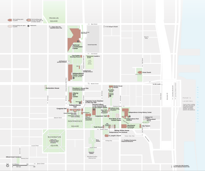
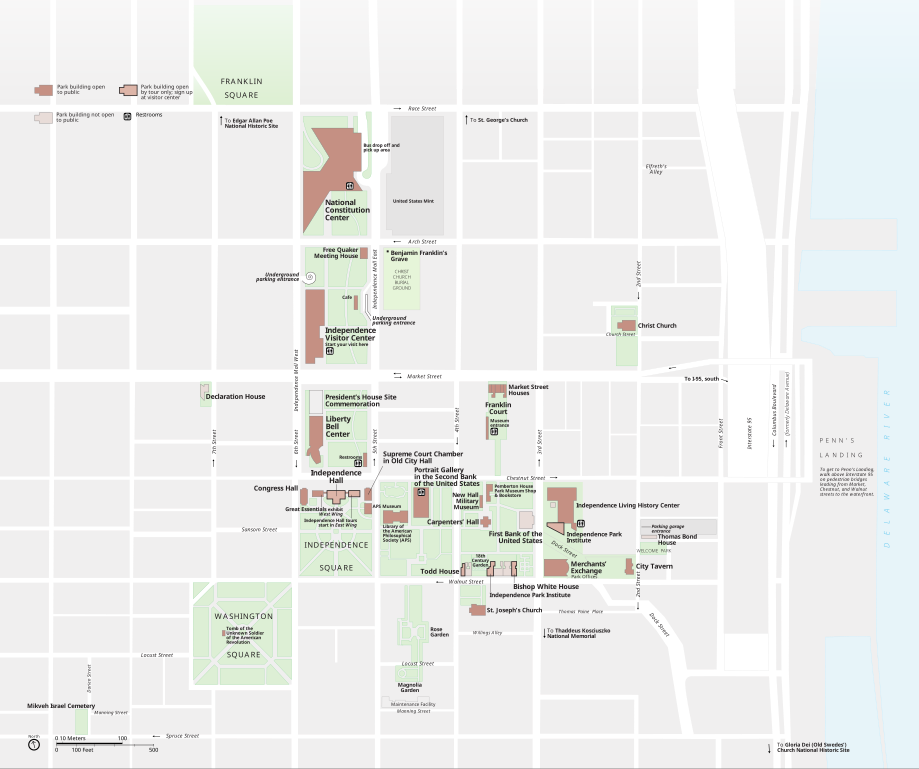
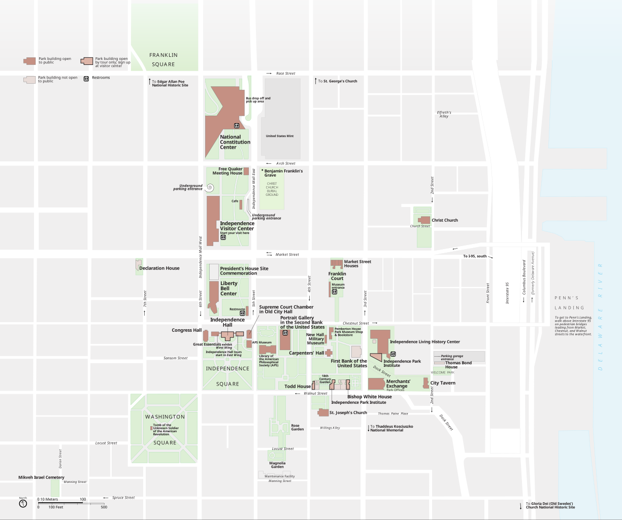
English: Map of Independence National Historical Park in Philadelphia created by the National Park Service. Original version. |
| Date | |
| Source | National Park Service |
| Author | Harpers Ferry Center |
Licensing[edit]
| This image or media file contains material based on a work of a National Park Service employee, created as part of that person's official duties. As a work of the U.S. federal government, such work is in the public domain in the United States. See the NPS website and NPS copyright policy for more information. |
File history
Click on a date/time to view the file as it appeared at that time.
| Date/Time | Thumbnail | Dimensions | User | Comment | |
|---|---|---|---|---|---|
| current | 19:54, 28 May 2011 | | 1,511 × 1,263 (880 KB) | Apollo1758 (talk | contribs) |
You cannot overwrite this file.
File usage on Commons
There are no pages that use this file.
File usage on other wikis
The following other wikis use this file:
- Usage on fi.wikipedia.org