File:Ifpo 21255 Syrie, Plateau du Golan, al-'Al, vue aérienne verticale (cropped).jpg
Jump to navigation
Jump to search

Size of this preview: 800 × 551 pixels. Other resolutions: 320 × 220 pixels | 640 × 441 pixels | 1,024 × 705 pixels | 1,280 × 881 pixels | 1,638 × 1,128 pixels.
Original file (1,638 × 1,128 pixels, file size: 212 KB, MIME type: image/jpeg)
Captions
Captions
Add a one-line explanation of what this file represents
| Photographer |
|
|||||||||||
| Description |
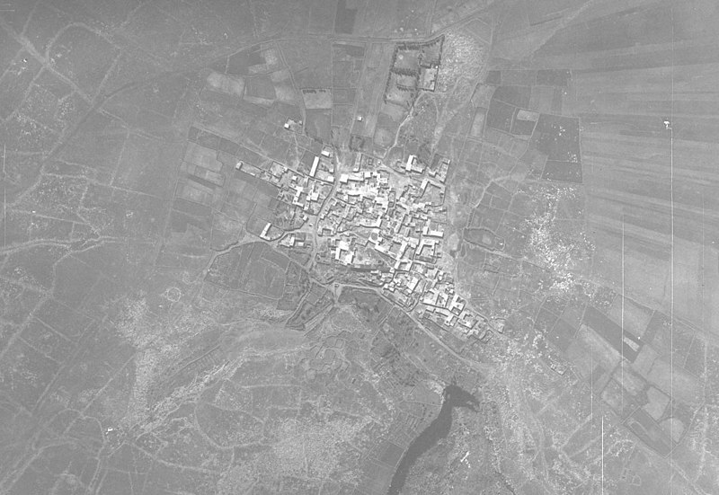
Français : Syrie, Plateau du Golan, al-'Al, vue aérienne verticale |
|||||||||||
| Date |
Taken on 8 March 1935 11 March 2020, 16:12:44 (upload date) |
|||||||||||
| Medium | dry plate | |||||||||||
| Dimensions | height: 18 cm (7 in); width: 24 cm (9.4 in) | |||||||||||
| Collection |
|
|||||||||||
| Accession number |
hal-02505622 Ifpo-21255 |
|||||||||||
| Object history | French army | |||||||||||
| Credit line |
Français : Institut français du Proche-Orient (Ifpo) ; ALIPH – Alliance internationale pour la protection du patrimoine dans les zones en conflit |
|||||||||||
| Source |
https://hal.archives-ouvertes.fr/hal-02505622 https://hal.archives-ouvertes.fr/hal-02505622/document |
|||||||||||
| Permission (Reusing this file) |
|
|||||||||||
| Other versions | ||||||||||||
| Mots-clés | Français : Photographie aérienne verticale,Photographie aérienne,Vue aérienne,Plateau du Golan,Syrie,Archéologie,Az-Zawiyah,Az-Zawiyeh,Zaouiyé,Al-'Al,El-Al,Al-ʿāl |
|||||||||||

| Camera location | | View this and other nearby images on: OpenStreetMap |
|---|
.jpg¶ms=032.810997_N_0035.737288_E_globe:Earth_type:camera__&language=en)
File history
Click on a date/time to view the file as it appeared at that time.
| Date/Time | Thumbnail | Dimensions | User | Comment | |
|---|---|---|---|---|---|
| current | 12:42, 9 May 2021 | | 1,638 × 1,128 (212 KB) | Don-vip (talk | contribs) | File:Ifpo 21255 Syrie, Plateau du Golan, al-'Al, vue aérienne verticale.jpg cropped 21 % horizontally, 28 % vertically using CropTool with lossless mode. |
You cannot overwrite this file.
File usage on Commons
The following 2 pages use this file:
.jpg)
.jpg&oldid=668681114)