File:Irene 2011-08-27 1145Z.jpg
Jump to navigation
Jump to search

Size of this preview: 800 × 600 pixels. Other resolutions: 320 × 240 pixels | 640 × 480 pixels | 1,024 × 768 pixels | 1,280 × 960 pixels | 2,000 × 1,500 pixels.
Original file (2,000 × 1,500 pixels, file size: 3.03 MB, MIME type: image/jpeg)
Captions
Captions
Add a one-line explanation of what this file represents
Summary
[edit]
| Description |
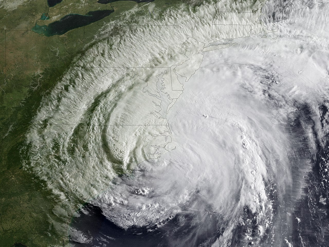
English: Hurricane Irene made landfall at approximately 7:30 am EDT near Cape Lookout, North Carolina with maximum sustained winds of 85 mph (Category 1). These two NOAA GOES-13 satellite images capture Irene’s landfall moment. The first uses the visible sensor; the second is colorized infrared imagery. Hurricane warnings are in effect for much of the U.S. coast from North Carolina to Maine, as the latest National Hurricane Center’s projected path has it skirting the coast over the next 24 hours, possibly heading inland along Long Island, NY. |
| Date | |
| Source | https://www.nnvl.noaa.gov/MediaDetail2.php?MediaID=817&MediaTypeID=1 |
| Author | NOAA |
Licensing
[edit]
This image is in the public domain because it contains materials that originally came from the U.S. National Oceanic and Atmospheric Administration, taken or made as part of an employee's official duties.
|
File history
Click on a date/time to view the file as it appeared at that time.
| Date/Time | Thumbnail | Dimensions | User | Comment | |
|---|---|---|---|---|---|
| current | 14:44, 15 April 2018 | | 2,000 × 1,500 (3.03 MB) | A1Cafel (talk | contribs) | User created page with UploadWizard |
You cannot overwrite this file.
File usage on Commons
The following page uses this file: