File:Izu Islands and Zenisu Ridge 500m mesh bathymetry.png
Jump to navigation
Jump to search
Size of this preview: 800 × 600 pixels. Other resolutions: 320 × 240 pixels | 640 × 480 pixels | 1,024 × 768 pixels | 1,120 × 840 pixels.
Original file (1,120 × 840 pixels, file size: 1.32 MB, MIME type: image/png)
Captions
Captions
Add a one-line explanation of what this file represents
Summary[edit]
| Description |
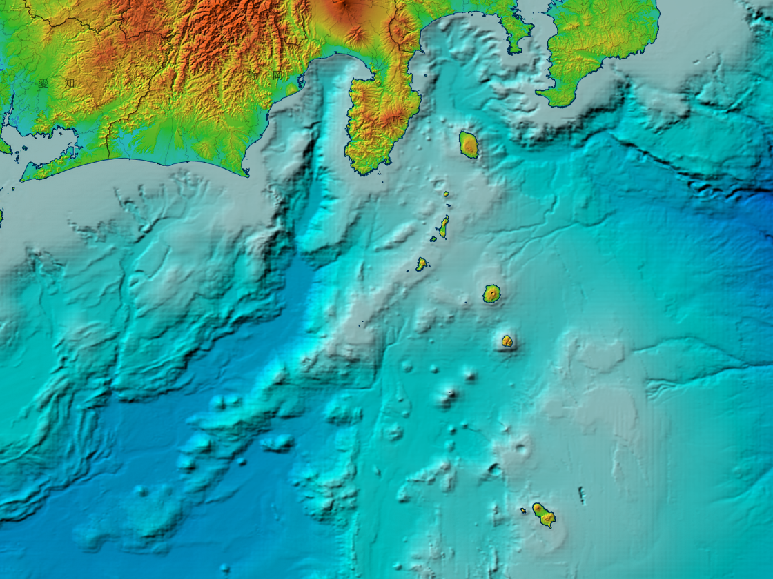
日本語: 伊豆七島と銭洲海嶺付近の海底地形図。国土地理院 地理院地図の色別標高図を使用。ただし、海域部は海上保安庁海洋情報部の資料(500mメッシュ海底地形データ, J-EGG500)を使用。
English: Bathymetric map around Northern Izu Islands and Zenisu Ridge, Japan. Topography data by GSI Maps from Geospatial Information Authority of Japan. Ocean bathymetry data by J-EGG500 from Hydrographic and Oceanographic Department, Japan Coast Guard. |
| Date | |
| Source | 地理院地図のwebビューアを利用して作成。使用タイルは色別標高図と白地図。色別標高図の海域部は海上保安庁海洋情報部の資料(500mメッシュ海底地形データ, J-EGG500)を使用して作成されているもの[1]。 |
| Author | Land topography and viewer by 国土地理院 (Geospatial Information Authority of Japan), Bathymetry by 海上保安庁海洋情報部 (Hydrographic and Oceanographic Department, Japan Coast Guard). Captured by Peka. |
Licensing[edit]

|
This work is licensed under the Government of Japan Standard Terms of Use (Ver.2.0). The Terms of Use are compatible with the Creative Commons Attribution License 4.0 International. For the terms of use of this work, see this license page.
|
This file is licensed under the Creative Commons Attribution 4.0 International license.
Attribution: 国土地理院 (GSI)
- You are free:
- to share – to copy, distribute and transmit the work
- to remix – to adapt the work
- Under the following conditions:
- attribution – You must give appropriate credit, provide a link to the license, and indicate if changes were made. You may do so in any reasonable manner, but not in any way that suggests the licensor endorses you or your use.
File history
Click on a date/time to view the file as it appeared at that time.
| Date/Time | Thumbnail | Dimensions | User | Comment | |
|---|---|---|---|---|---|
| current | 09:33, 18 February 2023 | | 1,120 × 840 (1.32 MB) | Peka (talk | contribs) | Uploaded a work by Land topography and viewer by [http://www.gsi.go.jp/ 国土地理院 (Geospatial Information Authority of Japan)], Bathymetry by 海上保安庁海洋情報部 (Hydrographic and Oceanographic Department, Japan Coast Guard). Captured by Peka. from [https://maps.gsi.go.jp/ 地理院地図]のwebビューアを利用して作成。使用タイルは[https://maps.gsi.go.jp/development/ichiran.html#relief 色別標高図]と[https://maps.gsi.go.jp/development/ichiran.html#blank 白地図]。色別標高図の海域部は海上保安庁海洋情報部の資料(500mメッシュ海底地形データ, J-EGG500)を使用して作成されているもの[https... |
You cannot overwrite this file.
File usage on Commons
There are no pages that use this file.
File usage on other wikis
The following other wikis use this file: