File:Jamaica Road, Bermondsey - geograph.org.uk - 507884.jpg
Jump to navigation
Jump to search
Size of this preview: 450 × 600 pixels. Other resolutions: 180 × 240 pixels | 480 × 640 pixels.
Original file (480 × 640 pixels, file size: 113 KB, MIME type: image/jpeg)
Captions
Captions
Add a one-line explanation of what this file represents
Summary[edit]
| Description |
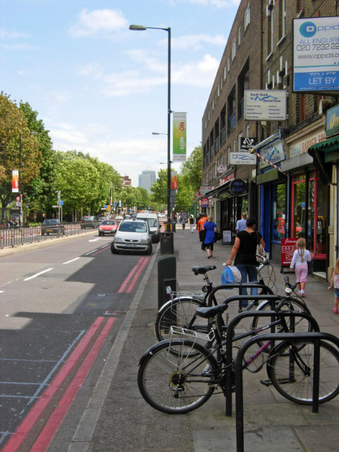
English: Jamaica Road, Bermondsey Looking east along Jamaica Road, the A200, a main route into south-east London. The name is believed to have derived from Jamaica House which stood nearby until about 1860. The house is mentioned by Samuel Pepys in his diary in 1667, and was itself probably named after the newly-acquired colony. |
| Date | |
| Source | From geograph.org.uk |
| Author | Stephen McKay |
| Attribution (required by the license) | Stephen McKay / Jamaica Road, Bermondsey / |
| Camera location | | View this and other nearby images on: OpenStreetMap |
|---|
_heading:67.00&language=en)
| Object location | | View this and other nearby images on: OpenStreetMap |
|---|
_heading:67.00&language=en)
Licensing[edit]

|
This image was taken from the Geograph project collection. See this photograph's page on the Geograph website for the photographer's contact details. The copyright on this image is owned by Stephen McKay and is licensed for reuse under the Creative Commons Attribution-ShareAlike 2.0 license.
|
This file is licensed under the Creative Commons Attribution-Share Alike 2.0 Generic license.
Attribution: Stephen McKay
- You are free:
- to share – to copy, distribute and transmit the work
- to remix – to adapt the work
- Under the following conditions:
- attribution – You must give appropriate credit, provide a link to the license, and indicate if changes were made. You may do so in any reasonable manner, but not in any way that suggests the licensor endorses you or your use.
- share alike – If you remix, transform, or build upon the material, you must distribute your contributions under the same or compatible license as the original.
File history
Click on a date/time to view the file as it appeared at that time.
| Date/Time | Thumbnail | Dimensions | User | Comment | |
|---|---|---|---|---|---|
| current | 09:00, 5 February 2011 | | 480 × 640 (113 KB) | GeographBot (talk | contribs) | == {{int:filedesc}} == {{Information |description={{en|1=Jamaica Road, Bermondsey Looking east along Jamaica Road, the A200, a main route into south-east London. The name is believed to have derived from Jamaica House which stood nearby until about 1860. |
You cannot overwrite this file.
File usage on Commons
There are no pages that use this file.