File:James Cook NF West coast.jpg
Jump to navigation
Jump to search

Size of this preview: 684 × 600 pixels. Other resolutions: 274 × 240 pixels | 548 × 480 pixels | 876 × 768 pixels | 1,168 × 1,024 pixels | 1,368 × 1,199 pixels.
Original file (1,368 × 1,199 pixels, file size: 348 KB, MIME type: image/jpeg)
Captions
Captions
Add a one-line explanation of what this file represents
Summary[edit]
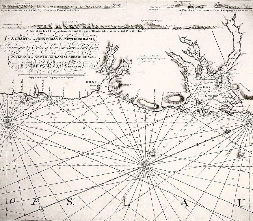
| Description | A chart of the west coast of Newfoundland, commissioned by Commodore Hugh Palliser, Governor of Newfoundland from 1764 to 1768, and printed by Robert Sayer & J. Bennett of London in 1770. |
| Date | |
| Source | http://www.heritage.nf.ca/exploration/chwest_coast_500.html Courtesy of the Centre for Newfoundland Studies, Queen Elizabeth II Library, Memorial University of Newfoundland, St. John's, Newfoundland |
| Author | James Cook |
| Permission (Reusing this file) |
Public domain because of age |
Licensing[edit]
|
This work is in the public domain in its country of origin and other countries and areas where the copyright term is the author's life plus 100 years or fewer. | |
| This file has been identified as being free of known restrictions under copyright law, including all related and neighboring rights. | |
File history
Click on a date/time to view the file as it appeared at that time.
| Date/Time | Thumbnail | Dimensions | User | Comment | |
|---|---|---|---|---|---|
| current | 11:22, 1 February 2008 | | 1,368 × 1,199 (348 KB) | Shipguy (talk | contribs) | == Summary == {{Information |Description=A chart of the west coast of Newfoundland, commissioned by Commodore Hugh Palliser, Governor of Newfoundland from 1764 to 1768, and printed by Robert Sayer & J. Bennett of London in 1770. |Source=http://www.herita |
You cannot overwrite this file.
File usage on Commons
There are no pages that use this file.