File:Japan location map-topographic.png
Jump to navigation
Jump to search
Size of this preview: 602 × 600 pixels. Other resolutions: 241 × 240 pixels | 482 × 480 pixels | 771 × 768 pixels | 1,027 × 1,024 pixels | 1,482 × 1,477 pixels.
Original file (1,482 × 1,477 pixels, file size: 1.24 MB, MIME type: image/png)
Captions
Captions
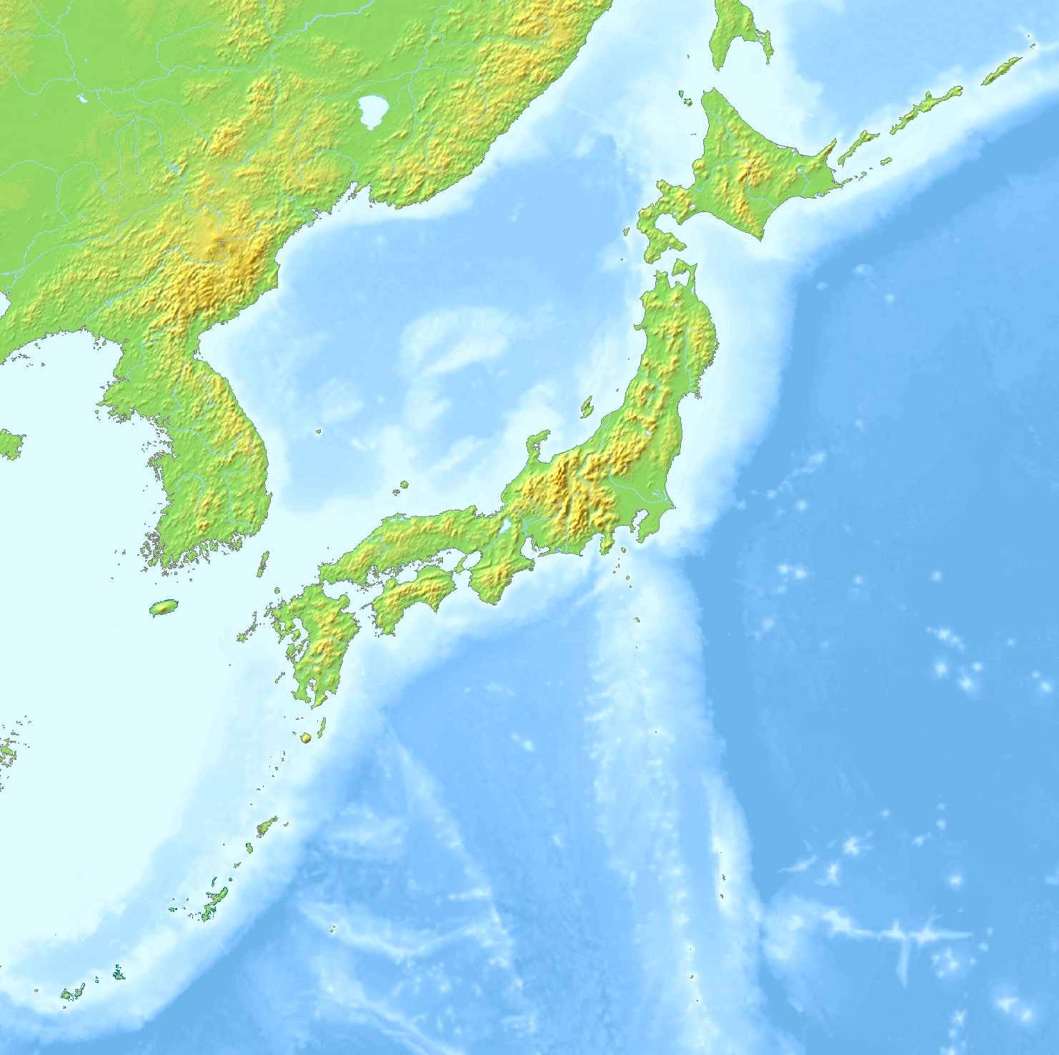
Topographic map of Japan.
Summary[edit]
| Description |
Français : Version topographique de File:Japan location map.svg. Construite à partir de File:Topographic30deg N30E120.png et des cartes voisines.
English: Topographic version of File:Japan location map.svg. Built from File:Topographic30deg N30E120.png and neighbouring maps. |
| Date | |
| Source | Own work |
| Author | GrandEscogriffe |
| Other versions |
|


Licensing[edit]
I, the copyright holder of this work, hereby publish it under the following license:
This file is licensed under the Creative Commons Attribution-Share Alike 4.0 International license.
- You are free:
- to share – to copy, distribute and transmit the work
- to remix – to adapt the work
- Under the following conditions:
- attribution – You must give appropriate credit, provide a link to the license, and indicate if changes were made. You may do so in any reasonable manner, but not in any way that suggests the licensor endorses you or your use.
- share alike – If you remix, transform, or build upon the material, you must distribute your contributions under the same or compatible license as the original.
File history
Click on a date/time to view the file as it appeared at that time.
| Date/Time | Thumbnail | Dimensions | User | Comment | |
|---|---|---|---|---|---|
| current | 15:34, 7 May 2021 | | 1,482 × 1,477 (1.24 MB) | GrandEscogriffe (talk | contribs) | Uploaded own work with UploadWizard |
You cannot overwrite this file.
File usage on Commons
The following 5 pages use this file:
File usage on other wikis
The following other wikis use this file:
- Usage on ca.wikipedia.org
- Usage on fr.wikipedia.org
- Usage on is.wikipedia.org
- Usage on uz.wikipedia.org