File:John Wesley Conant House historical marker, 5683 Napier Road, Salem Township, Michigan - panoramio.jpg
Jump to navigation
Jump to search
Size of this preview: 400 × 600 pixels. Other resolutions: 160 × 240 pixels | 320 × 480 pixels | 512 × 768 pixels | 682 × 1,024 pixels | 1,365 × 2,048 pixels | 3,168 × 4,752 pixels.
Original file (3,168 × 4,752 pixels, file size: 7.34 MB, MIME type: image/jpeg)
Captions
Captions
Add a one-line explanation of what this file represents
Summary[edit]
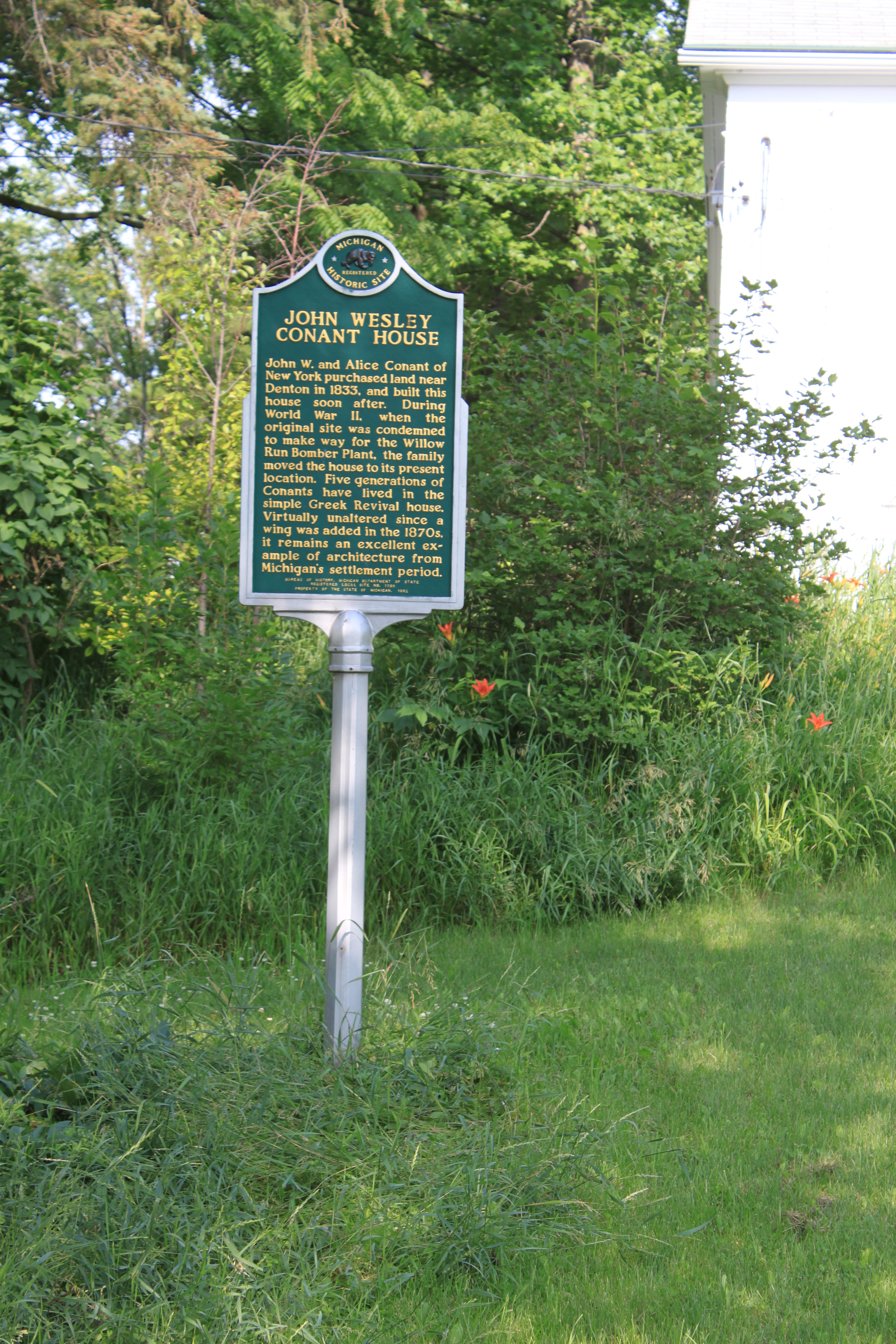
| Description | John Wesley Conant House historical marker, 5683 Napier Road, Salem Township, Michigan | ||
| Date | Taken on 27 June 2011 | ||
| Source | https://web.archive.org/web/20161022161628/http://www.panoramio.com/photo/54847727 | ||
| Author | Dwight Burdette | ||
| Permission (Reusing this file) |
This file is licensed under the Creative Commons Attribution 3.0 Unported license. Attribution: Dwight Burdette
|
||
| Tags (from Panoramio photo page) | Salem Township, 2011, historic marker, House, John wesley Conant, MI, Salem, USA |
| Camera location | | View this and other nearby images on: OpenStreetMap |
|---|

File history
Click on a date/time to view the file as it appeared at that time.
| Date/Time | Thumbnail | Dimensions | User | Comment | |
|---|---|---|---|---|---|
| current | 03:36, 30 November 2016 | | 3,168 × 4,752 (7.34 MB) | Panoramio upload bot (talk | contribs) | == {{int:filedesc}} == {{Information |description=John Wesley Conant House historical marker, 5683 Napier Road, Salem Township, Michigan |date={{Taken on|2011-06-27}} |source=http://www.panoramio.com/photo/54847727 |author=[http://www.panoramio.com/use... |
You cannot overwrite this file.
File usage on Commons
There are no pages that use this file.