File:Kühlung LRO.png
Jump to navigation
Jump to search
Size of this preview: 708 × 600 pixels. Other resolutions: 283 × 240 pixels | 567 × 480 pixels | 907 × 768 pixels | 1,209 × 1,024 pixels | 1,876 × 1,589 pixels.
Original file (1,876 × 1,589 pixels, file size: 184 KB, MIME type: image/png)
Captions
Captions
Add a one-line explanation of what this file represents
Summary[edit]
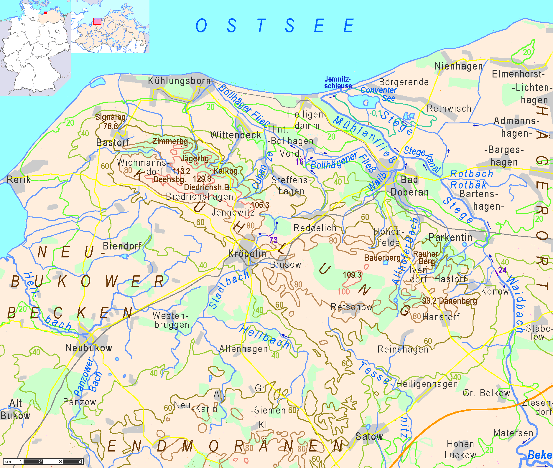
| Description | topographic map of Kühlung hills in Landkreis Rostock |
| Date | |
| Source | Own work |
| Author | Ulamm |
Licensing[edit]
I, the copyright holder of this work, hereby publish it under the following licenses:

|
Permission is granted to copy, distribute and/or modify this document under the terms of the GNU Free Documentation License, Version 1.2 or any later version published by the Free Software Foundation; with no Invariant Sections, no Front-Cover Texts, and no Back-Cover Texts. A copy of the license is included in the section entitled GNU Free Documentation License. |
This file is licensed under the Creative Commons Attribution-Share Alike 3.0 Unported license.
- You are free:
- to share – to copy, distribute and transmit the work
- to remix – to adapt the work
- Under the following conditions:
- attribution – You must give appropriate credit, provide a link to the license, and indicate if changes were made. You may do so in any reasonable manner, but not in any way that suggests the licensor endorses you or your use.
- share alike – If you remix, transform, or build upon the material, you must distribute your contributions under the same or compatible license as the original.
You may select the license of your choice.
File history
Click on a date/time to view the file as it appeared at that time.
| Date/Time | Thumbnail | Dimensions | User | Comment | |
|---|---|---|---|---|---|
| current | 23:55, 19 December 2013 | | 1,876 × 1,589 (184 KB) | Ulamm (talk | contribs) | local spelling conventions |
| 17:12, 8 December 2013 |  | 1,876 × 1,589 (184 KB) | Ulamm (talk | contribs) | new locator maps | |
| 10:44, 8 December 2013 |  | 1,876 × 1,589 (177 KB) | Ulamm (talk | contribs) | dark blue dimmed | |
| 10:38, 8 December 2013 |  | 1,876 × 1,589 (177 KB) | Ulamm (talk | contribs) | water contoures dimmed | |
| 09:57, 8 December 2013 |  | 1,876 × 1,589 (177 KB) | Ulamm (talk | contribs) | less water levels, lighter 20 metres contoure | |
| 08:12, 8 December 2013 |  | 1,876 × 1,589 (178 KB) | Ulamm (talk | contribs) | level contours a bit recoloured | |
| 15:51, 6 December 2013 |  | 1,876 × 1,589 (178 KB) | Ulamm (talk | contribs) | + names of neighbouring landscapes | |
| 08:25, 6 December 2013 |  | 1,876 × 1,589 (175 KB) | Ulamm (talk | contribs) | + scale | |
| 06:21, 6 December 2013 |  | 1,876 × 1,589 (174 KB) | Ulamm (talk | contribs) | {{Information |Description=topographic map of Kühlung hills in Landkreis Rostock |Source= own work |Date= 2013-12-06 |Author= Ulamm |Permission= |other_versions= }} Category:Maps of Mecklenburg-Vorpommern [[Category:Topographic map... |
You cannot overwrite this file.
File usage on Commons
The following page uses this file:
File usage on other wikis
The following other wikis use this file:
- Usage on de.wikipedia.org
- Usage on en.wikipedia.org
- Usage on www.wikidata.org