File:Kanal-mazurski-profil.png

Original file (2,444 × 1,860 pixels, file size: 248 KB, MIME type: image/png)
Captions
Captions
Summary
[edit]
| Description |
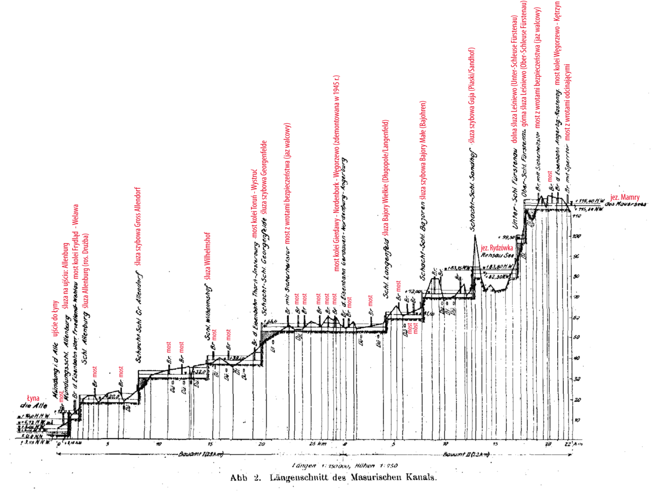
English: longitudinal profile of the Masurian Canal in Northeast Poland (until 1945 south of East Prussia in Germany) Polski: Profil wysokościowy Kanału Mazurskiego. Zawiera wszystkie śluzy i jazy na szlaku kanału. |
| Date | |
| Source | Der Maurische Kanal: Zweckbestimmung und Entstehungsgeschichte, Linienführung und Längenschnitt, Wasserwirtschaft. (1916). Zentralblatt der Bauverwaltung, [online] 83(36), pp.5-8. Available at: http://nbn-resolving.de/urn:nbn:de:kobv:109-opus-50506. |
| Author | Ziegler, polish annotations: Lyck |
| Other versions | Derivative works of this file: Masurischer Kanal Profil 001.png |
Licensing
[edit]
|
This work is in the public domain in its country of origin and other countries and areas where the copyright term is the author's life plus 70 years or fewer.
| |
| This file has been identified as being free of known restrictions under copyright law, including all related and neighboring rights. | |
File history
Click on a date/time to view the file as it appeared at that time.
| Date/Time | Thumbnail | Dimensions | User | Comment | |
|---|---|---|---|---|---|
| current | 22:05, 3 December 2008 | | 2,444 × 1,860 (248 KB) | Lyck~commonswiki (talk | contribs) | ({{Information |Description={{en|1=longitudinal profile of the Masurian Canal in Northeast Poland (until 1945 south of East Prussia in Germany)}} {{pl|1=Profil wysokościowy Kanału Mazurskiego. Zawiera wszystkie śluzy i jazy na szlaku kanału.}} |Source |
You cannot overwrite this file.
File usage on Commons
The following page uses this file: