File:Kanazawa health center stereo.jpg
Jump to navigation
Jump to search
Size of this preview: 800 × 302 pixels. Other resolutions: 320 × 121 pixels | 640 × 241 pixels | 1,342 × 506 pixels.
Original file (1,342 × 506 pixels, file size: 842 KB, MIME type: image/jpeg)
Captions
Captions
Add a one-line explanation of what this file represents
Summary
[edit]
| Description |
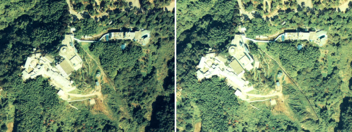
日本語: 石川県金沢市金沢ヘルスセンターのステレオ空中写真。ccb-75-22_c9b_1およびccb-75-22_c9b_2を使用。 |
| Date | |
| Source | 国土情報ウェブマッピングシステム |
| Author | 国土交通省 |
| Camera location | | View this and other nearby images on: OpenStreetMap |
|---|
Licensing
[edit]

|
The copyright holder of this file, the Ministry of Land, Infrastructure, Transport and Tourism of Japan, allows anyone to use it for any purpose, provided that the copyright holder is properly attributed. Redistribution, derivative work, commercial use, and all other use is permitted. |
Attribution:
Copyright © National Land Image Information (Color Aerial Photographs), Ministry of Land, Infrastructure, Transport and Tourism
|
 |
This image is copyrighted by the Ministry of Land, Infrastructure, Transport and Tourism of Japan. For terms of use, see the stipulation to use of National Land Information (in Japanese) and message from MLIT (in Japanese and English). When you display this image on an article, include the following phrase in the description: "Made based on National Land Image Information (Color Aerial Photographs), Ministry of Land, Infrastructure, Transport and Tourism".
|
File history
Click on a date/time to view the file as it appeared at that time.
| Date/Time | Thumbnail | Dimensions | User | Comment | |
|---|---|---|---|---|---|
| current | 12:12, 27 February 2012 | 1,342 × 506 (842 KB) | 名古屋太郎 (talk | contribs) | {{Information |Description ={{ja|1=石川県金沢市金沢ヘルスセンターのステレオ空中写真。ccb-75-22_c9b_1およびccb-75-22_c9b_2を使用。}} |Source =国土情報ウェブマッピングシステム |Author =�... |
You cannot overwrite this file.
File usage on Commons
The following page uses this file: