File:Karagie NASA.jpg
Jump to navigation
Jump to search

Size of this preview: 504 × 599 pixels. Other resolutions: 202 × 240 pixels | 584 × 694 pixels.
Original file (584 × 694 pixels, file size: 114 KB, MIME type: image/jpeg)
Captions
Captions
Add a one-line explanation of what this file represents
Summary[edit]
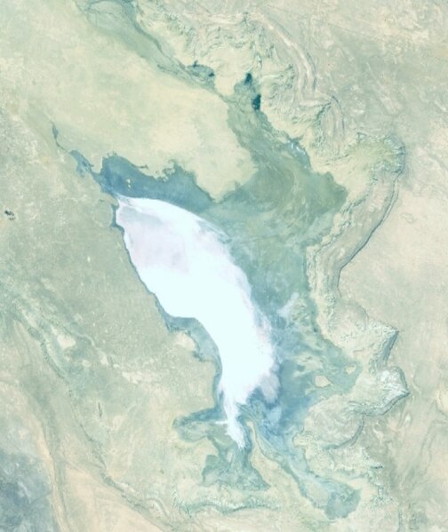
| Description |
Русский: Впадина Карагие, Прикаспий, Казахстан
English: Karagie depression, Kazakhstan |
| Date | Unknown date |
| Source | Screenshot from NASA World Wind software, Blue Marble & Landsat layer |
| Author | NASA |
| Object location | | View this and other nearby images on: OpenStreetMap |
|---|
Licensing[edit]
| This image is in the public domain because it is a screenshot from NASA’s globe software World Wind using a public domain layer, such as Blue Marble, MODIS, Landsat, SRTM, USGS or GLOBE.
|
 |
File history
Click on a date/time to view the file as it appeared at that time.
| Date/Time | Thumbnail | Dimensions | User | Comment | |
|---|---|---|---|---|---|
| current | 18:40, 25 April 2023 | | 584 × 694 (114 KB) | Proeksad (talk | contribs) | Uploaded a work by NASA from Screenshot from NASA World Wind software, Blue Marble & Landsat layer with UploadWizard |
You cannot overwrite this file.
File usage on Commons
There are no pages that use this file.