File:Kart over Søndre Trondhjems Amt, 1903.jpg
Jump to navigation
Jump to search

Size of this preview: 520 × 599 pixels. Other resolutions: 208 × 240 pixels | 416 × 480 pixels | 666 × 768 pixels | 888 × 1,024 pixels | 1,777 × 2,048 pixels | 8,031 × 9,258 pixels.
Original file (8,031 × 9,258 pixels, file size: 14.15 MB, MIME type: image/jpeg)
Captions
Captions
Add a one-line explanation of what this file represents
Summary[edit]
| Title |
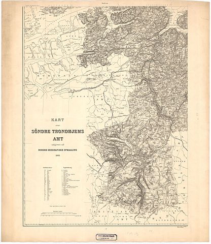
Norsk bokmål: Kart over Søndre Trondhjems Amt, 1903 |
||||||||||||||||||||||||||
| Description |
Norsk bokmål: Kart over Søndre Trondhjems Amt. 3. Kbst.1897; 1901 og 1904. |
||||||||||||||||||||||||||
| Date | |||||||||||||||||||||||||||
| Source |
|
||||||||||||||||||||||||||
| Creator |
Carl Bjune, Fr. Eriksen |
||||||||||||||||||||||||||
| Permission (Reusing this file) |
This file is licensed under the Creative Commons Attribution 4.0 International license.
|
||||||||||||||||||||||||||
| Geotemporal data | |||||||||||||||||||||||||||
| Date depicted | |||||||||||||||||||||||||||
| Map location | Sør-Trøndelag (Sør-Trøndelag) | ||||||||||||||||||||||||||
| Scale | 1:200,000 | ||||||||||||||||||||||||||
| Georeferencing | If inappropriate please set warp_status = skip to hide. | ||||||||||||||||||||||||||
| Bibliographic data | |||||||||||||||||||||||||||
| Part of the series | Category:Norwegian county map collection | ||||||||||||||||||||||||||
| Map sheet | 97-II | ||||||||||||||||||||||||||
| Language | Norwegian | ||||||||||||||||||||||||||
| Archival data | |||||||||||||||||||||||||||
| Collection |
|
||||||||||||||||||||||||||
| Accession number | |||||||||||||||||||||||||||
| Dimensions | ca. height: 75 cm (29.5 in); width: 65 cm (25.5 in) | ||||||||||||||||||||||||||
| Medium | copper plate copperplate | ||||||||||||||||||||||||||
File history
Click on a date/time to view the file as it appeared at that time.
| Date/Time | Thumbnail | Dimensions | User | Comment | |
|---|---|---|---|---|---|
| current | 21:51, 27 October 2015 | | 8,031 × 9,258 (14.15 MB) | Artturimatias (talk | contribs) | GWToolset: Creating mediafile for Artturimatias. |
You cannot overwrite this file.
File usage on Commons
The following page uses this file: