File:Karte über den Bornheimer Berg und Frankfurt.jpg
Jump to navigation
Jump to search
Size of this preview: 787 × 599 pixels. Other resolutions: 315 × 240 pixels | 630 × 480 pixels | 1,008 × 768 pixels | 1,280 × 975 pixels | 2,560 × 1,950 pixels | 3,000 × 2,285 pixels.
Original file (3,000 × 2,285 pixels, file size: 1.75 MB, MIME type: image/jpeg)
Captions
Captions
Add a one-line explanation of what this file represents
Summary[edit]
| Description |
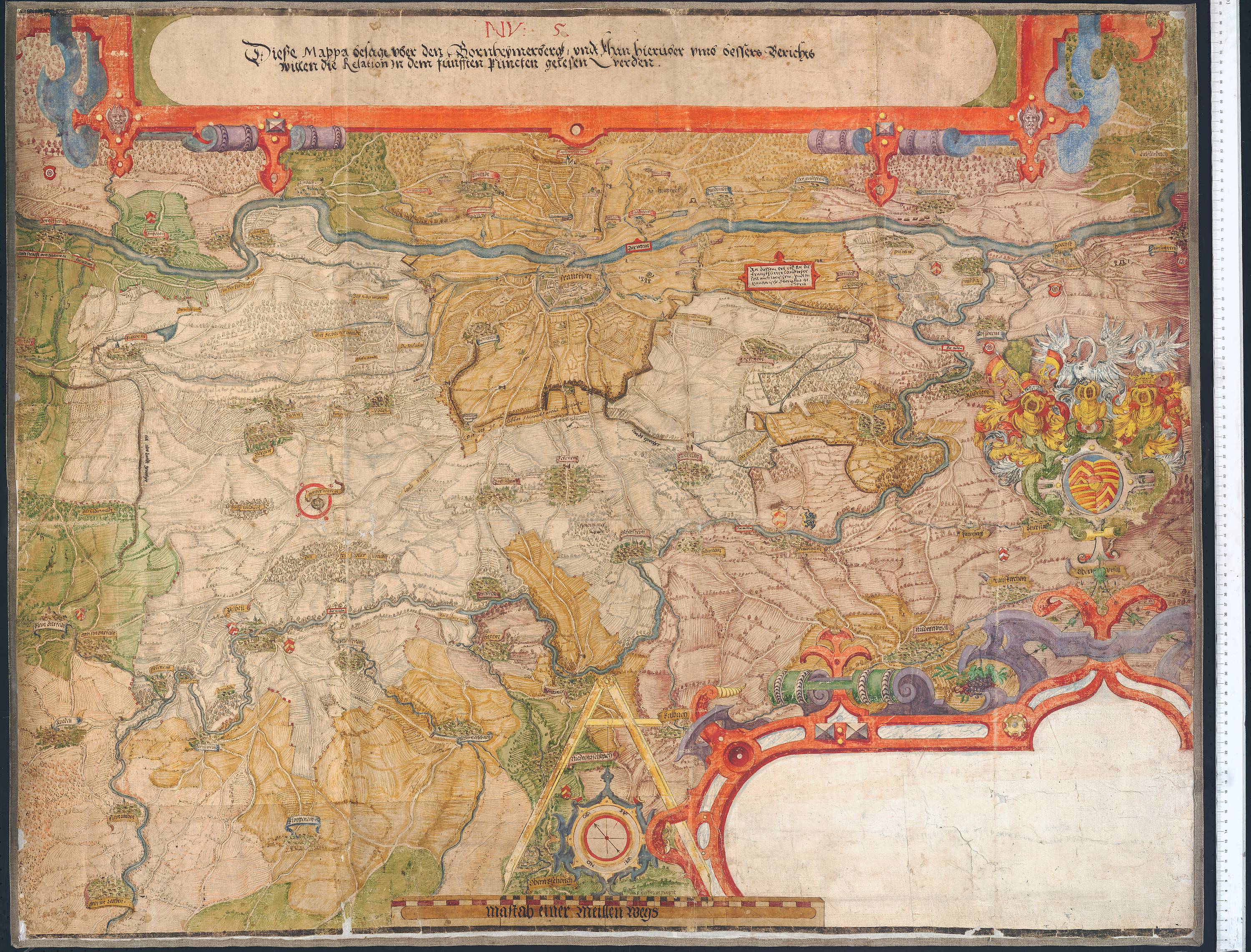
Deutsch: Karte über den Bornheimer Berg und Frankfurt, Gegend von Dörnigheim entlang am Main über Frankfurt bis Höchst, die Nidda entlang über Niederursel, Vilbel bis Groß-Karben, über Rendel und Bischhofsheim zurück an den Main, mit Darstellung von Offenbach, Kalbach, Kelsterbach, Schwanheim und Höchst, 1583 (Hessisches Staatsarchiv Marburg Karten Nr. R II 41). Zum Archivale: https://arcinsys.hessen.de/arcinsys/detailAction?detailid=v90859 |
| Date | |
| Source | Own work |
| Author | Hessisches Landesarchiv |
Licensing[edit]
I, the copyright holder of this work, hereby publish it under the following license:
This file is licensed under the Creative Commons Attribution-Share Alike 4.0 International license.
- You are free:
- to share – to copy, distribute and transmit the work
- to remix – to adapt the work
- Under the following conditions:
- attribution – You must give appropriate credit, provide a link to the license, and indicate if changes were made. You may do so in any reasonable manner, but not in any way that suggests the licensor endorses you or your use.
- share alike – If you remix, transform, or build upon the material, you must distribute your contributions under the same or compatible license as the original.
File history
Click on a date/time to view the file as it appeared at that time.
| Date/Time | Thumbnail | Dimensions | User | Comment | |
|---|---|---|---|---|---|
| current | 06:16, 28 April 2020 | | 3,000 × 2,285 (1.75 MB) | Hessisches Landesarchiv (talk | contribs) | Uploaded own work with UploadWizard |
You cannot overwrite this file.
File usage on Commons
There are no pages that use this file.
File usage on other wikis
The following other wikis use this file:
- Usage on de.wikipedia.org