File:Karte Bezirksamt Walldürn physisch.png
Jump to navigation
Jump to search
No higher resolution available.
Karte_Bezirksamt_Walldürn_physisch.png (691 × 521 pixels, file size: 459 KB, MIME type: image/png)
Captions
Captions
Add a one-line explanation of what this file represents
Summary[edit]
| Description |
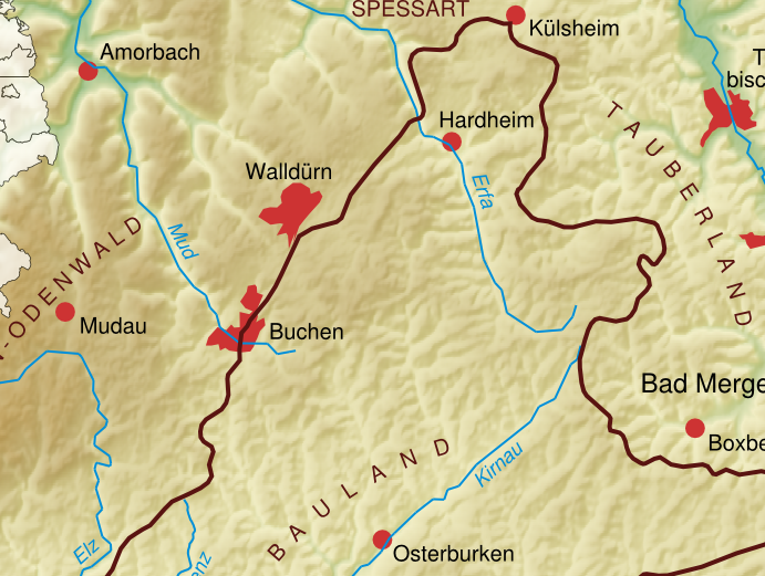
English: physical map of the Bauland in Baden-Württemberg, Germany. Deutsch: physische Karte des Baulands. |
| Date | |
| Source | own work, using SRTM3 data, Image:Eisenbahnstrecken noerdliches Baden-Wuerttemberg.svg. Bauland border line taken from [1] |
| Author | K. Jähne |

Licensing[edit]
| This work is ineligible for copyright and therefore in the public domain because it consists entirely of information that is common property and contains no original authorship. |
File history
Click on a date/time to view the file as it appeared at that time.
| Date/Time | Thumbnail | Dimensions | User | Comment | |
|---|---|---|---|---|---|
| current | 07:38, 15 August 2022 | | 691 × 521 (459 KB) | Kallewirsch (talk | contribs) | File:Karte Bauland physisch.png cropped 31 % horizontally, 40 % vertically using CropTool with precise mode. |
You cannot overwrite this file.
File usage on Commons
The following 4 pages use this file:
File usage on other wikis
The following other wikis use this file:
- Usage on de.wikipedia.org