File:Karte Deutsche Westbefestigungen vor Westwall.png
Jump to navigation
Jump to search
Size of this preview: 571 × 600 pixels. Other resolutions: 229 × 240 pixels | 457 × 480 pixels | 1,000 × 1,050 pixels.
Original file (1,000 × 1,050 pixels, file size: 1.56 MB, MIME type: image/png)
Captions
Captions
Add a one-line explanation of what this file represents
Summary
[edit]| Description |
|
|||
| Date | ||||
| Source | PNG conversion of Image:Karte_Deutsche_Westbefestigungen_vor_Westwall.svg | |||
| Author | K. Jähne | |||
| Other versions |
|


Licensing
[edit]
| This work has been released into the public domain by its author, kjunix. This applies worldwide. In some countries this may not be legally possible; if so: |
File history
Click on a date/time to view the file as it appeared at that time.
| Date/Time | Thumbnail | Dimensions | User | Comment | |
|---|---|---|---|---|---|
| current | 20:18, 20 October 2008 | | 1,000 × 1,050 (1.56 MB) | Kjunix (talk | contribs) | beautification |
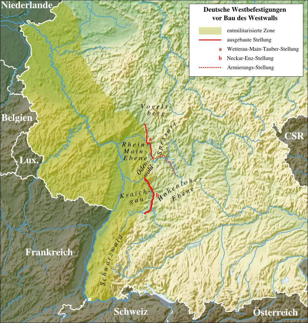
| 13:04, 22 June 2008 |  | 1,000 × 1,050 (1.43 MB) | Kjunix (talk | contribs) | == Description == {{Information| |Description = *{{de|Die deutschen Westbefestigungen vor dem Bau des Westwalls: Wetterau-Main-Tauber-Stellung und Neckar-Enz-Stellung.}} *{{en|German western line of defence before builing the Westwall: Wetterau-Main-Taube |
You cannot overwrite this file.
File usage on Commons
The following page uses this file:
File usage on other wikis
The following other wikis use this file:
- Usage on de.wikipedia.org