File:Karte Hannoversche Klippen.png
Jump to navigation
Jump to search

Size of this preview: 800 × 582 pixels. Other resolutions: 320 × 233 pixels | 640 × 465 pixels | 1,024 × 745 pixels | 1,280 × 931 pixels | 1,797 × 1,307 pixels.
Original file (1,797 × 1,307 pixels, file size: 460 KB, MIME type: image/png)
Captions
Captions
Add a one-line explanation of what this file represents
Summary[edit]
| Description |
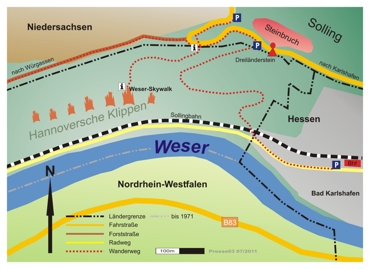
Deutsch: Lage der Hannoverschen Klippen bei Bad Karlshafen |
| Date | |
| Source |
Originally from de.wikipedia; description page is/was here. |
| Author | Presse03 |
| Permission (Reusing this file) |
Licensed under the GFDL by the author. |
Licensing[edit]
Presse03 at the German-language Wikipedia, the copyright holder of this work, hereby publishes it under the following license:

|
Permission is granted to copy, distribute and/or modify this document under the terms of the GNU Free Documentation License, Version 1.2 or any later version published by the Free Software Foundation; with no Invariant Sections, no Front-Cover Texts, and no Back-Cover Texts. A copy of the license is included in the section entitled GNU Free Documentation License. |
| This file is licensed under the Creative Commons Attribution-Share Alike 3.0 Unported license. | ||
| Attribution: Presse03 | ||
| ||
| This licensing tag was added to this file as part of the GFDL licensing update. |
Original upload log[edit]
(All user names refer to de.wikipedia)
- 2007-01-16 11:56 Presse03 1797×1307×8 (437196 bytes) {{Information |Beschreibung=Lage der Hannoverschen Klippen bei Bad Karlshafen |Quelle=selbst erstellt |Urheber=~~~ |Datum=16.01.2007 |Genehmigung=GFDL |Andere Versionen= |Anmerkungen=Kartenvorlage: Google Map }}

|
File:Hannoversche Klippen.svg is a vector version of this file. It should be used in place of this PNG file when not inferior.
File:Karte Hannoversche Klippen.png → File:Hannoversche Klippen.svg
For more information, see Help:SVG. |
 |
File history
Click on a date/time to view the file as it appeared at that time.
| Date/Time | Thumbnail | Dimensions | User | Comment | |
|---|---|---|---|---|---|
| current | 22:33, 18 August 2011 | | 1,797 × 1,307 (460 KB) | Presse03 (talk | contribs) | Reverted to version as of 07:09, 11 August 2011 |
| 22:31, 18 August 2011 |  | 1,797 × 1,307 (460 KB) | Presse03 (talk | contribs) | Reverted to version as of 07:25, 11 August 2011 | |
| 07:28, 11 August 2011 |  | 1,797 × 1,307 (460 KB) | Presse03 (talk | contribs) | Reverted to version as of 07:09, 11 August 2011 | |
| 07:25, 11 August 2011 |  | 1,797 × 1,307 (460 KB) | Presse03 (talk | contribs) | Wegeverlauf ab Feb. 2011 geändert | |
| 07:09, 11 August 2011 |  | 1,797 × 1,307 (460 KB) | Presse03 (talk | contribs) | Wegeverlauf ab Feb. 2011 geändert | |
| 16:32, 20 March 2007 |  | 1,797 × 1,307 (427 KB) | Presse03 (talk | contribs) | {{Information |Description=Lage der Hannoverschen Klippen bei Bad Karlshafen |Source=Originally from [http://de.wikipedia.org de.wikipedia]; description page is/was [http://de.wikipedia.org/w/index.php?title=Image%3AKarte_Hannoversche_Klippen.png here].<b |
You cannot overwrite this file.
File usage on Commons
The following page uses this file: