File:Karte Landkommissariat Kaiserslautern 1818-1862.svg
Jump to navigation
Jump to search

Size of this PNG preview of this SVG file: 617 × 599 pixels. Other resolutions: 247 × 240 pixels | 494 × 480 pixels | 791 × 768 pixels | 1,054 × 1,024 pixels | 2,109 × 2,048 pixels | 729 × 708 pixels.
Original file (SVG file, nominally 729 × 708 pixels, file size: 1.54 MB)
Captions
Captions
Add a one-line explanation of what this file represents
Summary[edit]
| Description |
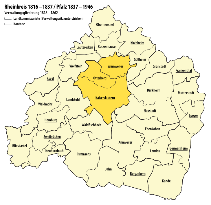
Verwaltungskarte vom Rheinkreis 1816 – 1837 bzw. der Pfalz 1837 – 1862 Hervorgehoben ist das Landkommissariat Kaiserslautern, das ab 1818 bestand und 1862 in Bezirksamt Kaiserslautern umbenannt wurde. |
| Date | see file history |
| Source | Own work using: Handkarte der Pfalz für Schulen 1844 |
| Author | Maximilian Dörrbecker (Chumwa) |
| Permission (Reusing this file) |
This file is licensed under the Creative Commons Attribution-Share Alike 2.5 Generic license.
|
File history
Click on a date/time to view the file as it appeared at that time.
| Date/Time | Thumbnail | Dimensions | User | Comment | |
|---|---|---|---|---|---|
| current | 17:35, 19 July 2017 | | 729 × 708 (1.54 MB) | Chumwa (talk | contribs) |
You cannot overwrite this file.
File usage on Commons
The following page uses this file:
File usage on other wikis
The following other wikis use this file:
- Usage on de.wikipedia.org