File:Karte Oberbergische Bahnen.png
Jump to navigation
Jump to search

Size of this preview: 800 × 593 pixels. Other resolutions: 320 × 237 pixels | 640 × 474 pixels | 1,024 × 759 pixels | 1,280 × 948 pixels | 2,203 × 1,632 pixels.
Original file (2,203 × 1,632 pixels, file size: 195 KB, MIME type: image/png)
Captions
Captions
Add a one-line explanation of what this file represents
Summary[edit]
| Description |
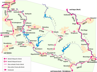
Deutsch: Karte der Bahnstrecken im Oberbergischen Land in Deutschland
English: map railroad trails in "Oberbergische Land", Germany |
| Date | 2007-05-2007. Nachtrag 2011: Bahnabschnitt 2700-Wermelskirchen ebenfalls stillgelegt. |
| Source | Own work |
| Author | Lantus |

|
This photo, this drawing or graph was taken by Lantus. If you use one of my photos, drawings or graphs, an email (account needed) or a message would be greatly appreciated. |
Licensing[edit]
I, the copyright holder of this work, hereby publish it under the following license:
This file is licensed under the Creative Commons Attribution-Share Alike 2.5 Generic, 2.0 Generic and 1.0 Generic license.
- You are free:
- to share – to copy, distribute and transmit the work
- to remix – to adapt the work
- Under the following conditions:
- attribution – You must give appropriate credit, provide a link to the license, and indicate if changes were made. You may do so in any reasonable manner, but not in any way that suggests the licensor endorses you or your use.
- share alike – If you remix, transform, or build upon the material, you must distribute your contributions under the same or compatible license as the original.
File history
Click on a date/time to view the file as it appeared at that time.
| Date/Time | Thumbnail | Dimensions | User | Comment | |
|---|---|---|---|---|---|
| current | 22:52, 8 June 2015 | | 2,203 × 1,632 (195 KB) | Cmdrjameson (talk | contribs) | Compressed with pngout. Reduced by 92kB (32% decrease). |
| 10:44, 12 February 2015 |  | 2,203 × 1,632 (287 KB) | Lantus (talk | contribs) | Dateigrösse reduziert, Bildgrösse reduziert | |
| 10:37, 12 February 2015 |  | 10,340 × 7,658 (1.26 MB) | Lantus (talk | contribs) | div. kl. Verbesserungen | |
| 17:26, 24 September 2009 |  | 1,615 × 1,200 (92 KB) | Lantus (talk | contribs) | Ortsname korregiert | |
| 15:21, 18 May 2007 |  | 1,615 × 1,200 (208 KB) | Lantus (talk | contribs) | {{Information |Description= Deutsch: Karte der Bahnstrecken im Oberbergischen Land in Deutschland English: map railroad trails in "Oberbergische Land", Germany |Source= own work |Date= 18.05.2007 |Author= ~~~~ |Permission= |other_versions= }} | |
| 14:49, 18 May 2007 |  | 1,615 × 1,200 (207 KB) | Lantus (talk | contribs) | {{Information |Description= Deutsch: Karte der Bahnstrecken im Oberbergischen Land in Deutschland English: map railroad trails in "Oberbergische Land", Germany |Source= own work |Date= 18.05.2007 |Author= ~~~~ |Permission= |other_versions= }} | |
| 09:31, 10 May 2007 |  | 1,603 × 1,200 (98 KB) | Lantus (talk | contribs) | {{Information |Description= map railroad trails in "Oberbergische Land", Germany |Source=self-made |Date=10.05.2007 |Author= User:Lantus }} |
You cannot overwrite this file.
File usage on Commons
The following 11 pages use this file:
- User:Atamari/BotGallery/Geology/2015 June 1-10
- User:Chumwa/OgreBot/Public transport information/2015 February 10-18
- User:Chumwa/OgreBot/Public transport information/2015 June 1-10
- User:Chumwa/OgreBot/Transport Maps/2015 February 10-18
- User:Chumwa/OgreBot/Transport Maps/2015 June 1-10
- User:Liesel/Rail transport/2015 February 10-18
- User:Nordlicht8/Rail Germany/2015 February 10-18
- User:Nordlicht8/Rail Germany/2015 June 1-10
- Category:Volmetalbahn
- Category:Wippertalbahn
- Category:Wuppertalbahn
File usage on other wikis
The following other wikis use this file:
- Usage on de.wikipedia.org
- Usage on en.wikipedia.org
- Usage on www.wikidata.org