File:Karte der Werrabahn.jpg
Jump to navigation
Jump to search

Size of this preview: 489 × 600 pixels. Other resolutions: 196 × 240 pixels | 391 × 480 pixels | 626 × 768 pixels | 835 × 1,024 pixels | 1,858 × 2,279 pixels.
Original file (1,858 × 2,279 pixels, file size: 1.2 MB, MIME type: image/jpeg)
Captions
Captions
Add a one-line explanation of what this file represents
| Description |
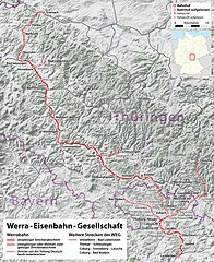
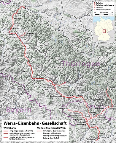
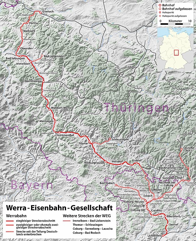
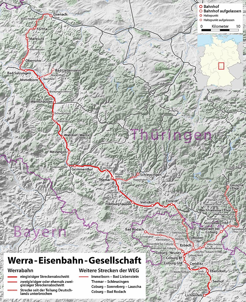
Deutsch: Karte der Werrabahn (Eisenach – Meiningen – Coburg – Lichtenfels) |
| Date | see file history |
| Source |
own work, using the following information:
|
| Author | Maximilian Dörrbecker (Chumwa) |
| Permission (Reusing this file) |
All OpenStreetMap data and maps are Creative Commons "CC-BY-SA 2.0" licensed This file is licensed under the Creative Commons Attribution-Share Alike 2.0 Generic license.
|
File history
Click on a date/time to view the file as it appeared at that time.
| Date/Time | Thumbnail | Dimensions | User | Comment | |
|---|---|---|---|---|---|
| current | 16:06, 19 August 2009 | | 1,858 × 2,279 (1.2 MB) | Chumwa (talk | contribs) | Oberrhon → Oberrohn, Nebenstrecken in hellerem rot, Legende angepasst |
| 05:40, 19 August 2009 |  | 1,858 × 2,279 (1.23 MB) | Chumwa (talk | contribs) | diverse Ergänzungen | |
| 20:39, 18 August 2009 |  | 1,777 × 2,279 (1.16 MB) | Chumwa (talk | contribs) | {{Information |Description={{de|Karte der Werrabahn (Eisenach – Hildburghausen – Coburg – Lichtenfels)}} |Source=own work, using the following information: * the topographic background is an GMT extract provided by Lencer. * road |
You cannot overwrite this file.
File usage on Commons
The following 2 pages use this file:
File usage on other wikis
The following other wikis use this file:
- Usage on de.wikipedia.org
- Usage on en.wikipedia.org
- Usage on pl.wikipedia.org
- Usage on www.wikidata.org