File:Karte rottweil.png
Jump to navigation
Jump to search
No higher resolution available.
Karte_rottweil.png (188 × 235 pixels, file size: 5 KB, MIME type: image/png)
Captions
Captions
Add a one-line explanation of what this file represents
Transferred from de.wikipedia to Commons by Maksim.
The original description page was here. All following user names refer to de.wikipedia.
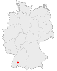
Karte von Rottweil aus OpenGeoDB (public domain, generated by Benutzer:mathilda)
This image was generated with OpenGeoDB. The information there is placed in the public domain, images generated from OpenGeoDB are derivative works without passing the threshold of creativity, they are therefore also public domain.
| This work is ineligible for copyright and therefore in the public domain because it consists entirely of information that is common property and contains no original authorship. |
| date/time | username | edit summary |
|---|---|---|
| 18:39, 14. Nov 2004 | de:Benutzer:JuergenL | ({{Bild-GFDL-OpenGeoDB}}) |
| 04:40, 20. Aug 2004 | de:Benutzer:Ma'ame Michu | (interwiki : en: fr:) |
| 22:00, 17. Jul 2004 | de:Benutzer:Mathilda | (added license) |
| 11:36, 10. Mai 2004 | de:Benutzer:Mathilda | (Karte von Rottweil aus OpenGeoDB) |
Original upload log[edit]
- 11:36, 10. Mai 2004 . . de:Benutzer:Mathilda Mathilda ( de:Benutzer_Diskussion:Mathilda Diskussion) . . 188 x 235 (5324 Byte) (Karte von Rottweil aus OpenGeoDB)
File history
Click on a date/time to view the file as it appeared at that time.
| Date/Time | Thumbnail | Dimensions | User | Comment | |
|---|---|---|---|---|---|
| current | 10:56, 29 January 2006 | | 188 × 235 (5 KB) | Maksim (talk | contribs) | La bildo estas kopiita de wikipedia:de. La originala priskribo estas: Karte von Rottweil aus OpenGeoDB (public domain, generated by Benutzer:mathilda) en:Image:Rottweil in Germany.png fr:Image:Rottweil in Germany.png {{GFDL-OpenGeoDB}} {| |
You cannot overwrite this file.
File usage on Commons
There are no pages that use this file.
File usage on other wikis
The following other wikis use this file:
- Usage on ca.wikipedia.org
- Usage on ceb.wikipedia.org
- Usage on de.wikipedia.org