File:Kashmir map-ks.png
Jump to navigation
Jump to search
Size of this preview: 764 × 600 pixels. Other resolutions: 306 × 240 pixels | 611 × 480 pixels | 978 × 768 pixels | 1,146 × 900 pixels.
Original file (1,146 × 900 pixels, file size: 244 KB, MIME type: image/png)
Captions
Captions
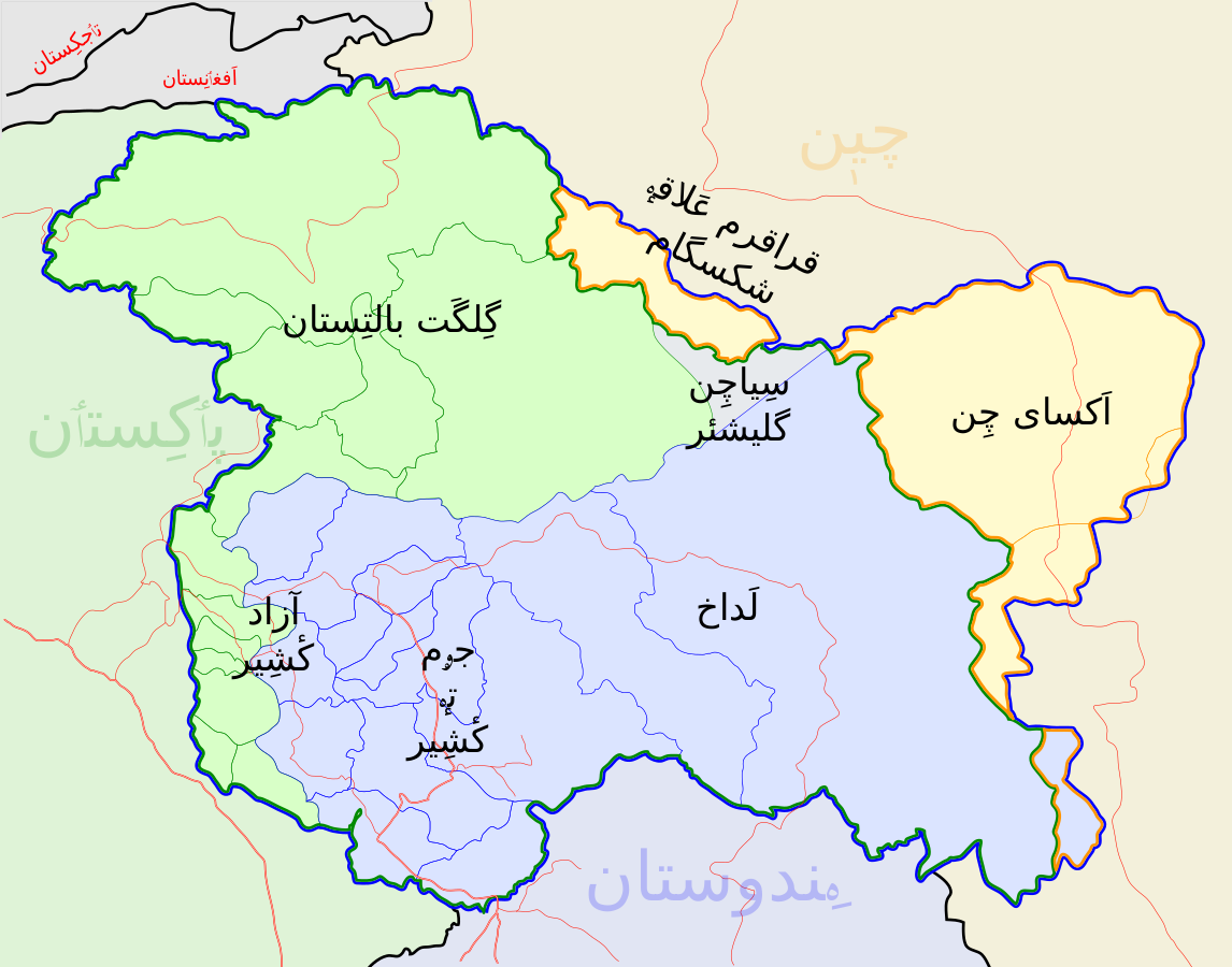
Kashmir map
Summary[edit]
| Description |
English: Map of Kashmir in Kashmiri language |
| Date | |
| Source |
Own work based on: Kashmir map.svg |
| Author | Arqamkhawaja (Original image: Planemad) |
| Permission (Reusing this file) |
Part of WikiProject India Maps |
| Other versions |
[]
Others[edit]
|
.svg)


Licensing[edit]
This file is licensed under the Creative Commons Attribution-Share Alike 3.0 Unported license.
- You are free:
- to share – to copy, distribute and transmit the work
- to remix – to adapt the work
- Under the following conditions:
- attribution – You must give appropriate credit, provide a link to the license, and indicate if changes were made. You may do so in any reasonable manner, but not in any way that suggests the licensor endorses you or your use.
- share alike – If you remix, transform, or build upon the material, you must distribute your contributions under the same or compatible license as the original.
File history
Click on a date/time to view the file as it appeared at that time.
| Date/Time | Thumbnail | Dimensions | User | Comment | |
|---|---|---|---|---|---|
| current | 11:20, 11 December 2022 | | 1,146 × 900 (244 KB) | Arqamkhawaja (talk | contribs) | Uploaded own work with UploadWizard |
You cannot overwrite this file.
File usage on Commons
The following 11 pages use this file:
- File:Kashmir-map-zh.svg
- File:Kashmir map-es.svg
- File:Kashmir map-hi.svg
- File:Kashmir map-ks.png
- File:Kashmir map.svg
- File:Kashmir map (old).svg
- File:Kashmir map 2019 Balakot airstrike.svg
- File:Kashmir map 2020 skirmish.svg
- File:Kashmir map as.svg
- File:কাশ্মীরের মানচিত্র.svg
- Template:Other versions/Kashmir map