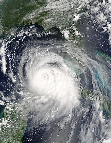
File:Katrina 2005-08-27 1620Z.jpg
From Wikimedia Commons, the free media repository
(Redirected from File:Katrina.A2005239.1620.250m.jpg)

Size of this preview: 466 × 599 pixels. Other resolutions: 187 × 240 pixels | 373 × 480 pixels | 597 × 768 pixels | 796 × 1,024 pixels | 1,593 × 2,048 pixels | 5,600 × 7,200 pixels.
Original file (5,600 × 7,200 pixels, file size: 8.13 MB, MIME type: image/jpeg)
File information
Structured data
Captions
Captions
Add a one-line explanation of what this file represents
Summary[edit]
| DescriptionKatrina 2005-08-27 1620Z.jpg |
Hurricane Katrina (12L) in the Gulf of Mexico, as seen by the MODIS instrument on NASA's Aqua satellite at 1620 UTC. English: August 27, 2005, marked the first day that an eye became apparent in satellite imagery of Hurricane Katrina. In the morning of August 27, Katrina’s winds reached 185 kilometers per hour (115 miles per hour), making the storm a Category 3 hurricane. When the Moderate Resolution Imaging Spectroradiometer (MODIS) on NASA’s Terra satellite captured this image at 11:20 a.m. U.S. Central time, the inner eyewall had begun to deteriorate and an outer eyewall was forming. The two eyewalls are clearly visible as two concentric circles at the center of the storm. Katrina was also expanding, and by the end of the day, had doubled in size.
The next day, Katrina exploded into a Category 5 hurricane with winds of 257 kilometers per hour (160 miles per hour). When Katrina came ashore on August 29, it was one of the deadliest and costliest storms to hit the United States. |
||||||
| Date | |||||||
| Source | http://rapidfire.sci.gsfc.nasa.gov/gallery/?2005239-0827/Katrina.A2005239.1620.2km.jpg | ||||||
| Author | Image courtesy of MODIS Rapid Response Project at NASA/GSFC | ||||||
| Permission (Reusing this file) |
|
File history
Click on a date/time to view the file as it appeared at that time.
| Date/Time | Thumbnail | Dimensions | User | Comment | |
|---|---|---|---|---|---|
| current | 15:29, 9 September 2007 |  | 5,600 × 7,200 (8.13 MB) | Good kitty (talk | contribs) | == Summary == {{Information |Description=Hurricane Katrina (12L) in the Gulf of Mexico, as seen by the MODIS instrument on NASA's Aqua satellite at 1620 UTC. |Source=http://rapidfire.sci.gsfc.nasa.gov/gallery/?2005239-0827/Katrina.A2005239.1620.2km.jpg |D |
You cannot overwrite this file.
File usage on Commons
The following 3 pages use this file:
- File:Katrina.A2005239.1620.250m.jpg (file redirect)
- File:Katrina 2005-08-27 1620Z (cropped).jpg
- File:Katrina 27 aug 2005 1620Z.jpg (file redirect)

