File:Kice Island chart.png
Jump to navigation
Jump to search
No higher resolution available.
Kice_Island_chart.png (684 × 565 pixels, file size: 439 KB, MIME type: image/png)
Captions
Captions
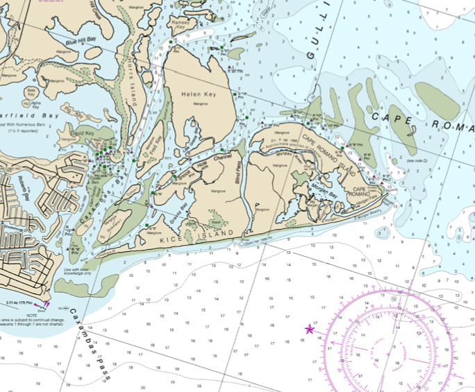
Navigational chart of Kice Island and Cape Romano, Florida
Summary[edit]
| Description |
English: This chart shows Kice Island, including former parts of the island that are now separated by new channels. Cape Romano is at the southern (right) end of the original Kice Island. |
| Date | |
| Source | https://www.charts.noaa.gov/PDFs/11430.pdf |
| Author | Staff of NOAA Coast Survey |
Licensing[edit]
This image is in the public domain because it contains materials that originally came from the U.S. National Oceanic and Atmospheric Administration, taken or made as part of an employee's official duties.
|
File history
Click on a date/time to view the file as it appeared at that time.
| Date/Time | Thumbnail | Dimensions | User | Comment | |
|---|---|---|---|---|---|
| current | 07:53, 11 August 2023 | | 684 × 565 (439 KB) | Donald Albury (talk | contribs) | Uploaded a work by Staff of NOAA Coast Survey from https://www.charts.noaa.gov/PDFs/11430.pdf with UploadWizard |
You cannot overwrite this file.
File usage on Commons
There are no pages that use this file.
File usage on other wikis
The following other wikis use this file:
- Usage on en.wikipedia.org