File:Kneiss.jpg
Jump to navigation
Jump to search
Size of this preview: 800 × 579 pixels. Other resolutions: 320 × 232 pixels | 640 × 463 pixels | 959 × 694 pixels.
Original file (959 × 694 pixels, file size: 292 KB, MIME type: image/jpeg)
Captions
Captions
Add a one-line explanation of what this file represents
| Description |
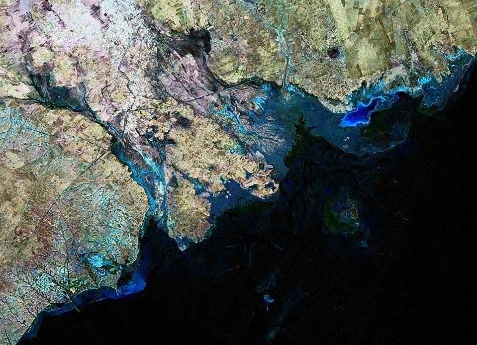
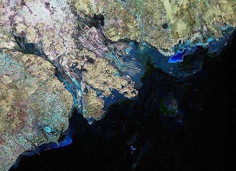
English: Satellite image of Kneiss Islands (Tunisia)
Français : Image satellite de l'archipel des îles Kneiss en Tunisie
العربية: صورة من قمر صناعي لأرخبيل الكنايس في تونس |
|||
| Date | ||||
| Source | Taken from NASA World Wind | |||
| Author | NASA | |||
| Permission (Reusing this file) |
|

File history
Click on a date/time to view the file as it appeared at that time.
| Date/Time | Thumbnail | Dimensions | User | Comment | |
|---|---|---|---|---|---|
| current | 17:21, 9 June 2008 | | 959 × 694 (292 KB) | DrFO.Jr.Tn (talk | contribs) | {{Information |Description={{en|1=Satellite image of Kneiss Islands (Tunisia)}} |Source=Taken from NASA World Wind |Author=NASA |Date=9 June 2008 |Permission={{PD-WorldWind}} |other_versions= }} {{ImageUpload|full}} [[Category:Satellite images of Tunisia |
You cannot overwrite this file.
File usage on Commons
The following 2 pages use this file:
File usage on other wikis
The following other wikis use this file:
- Usage on ar.wikipedia.org
- Usage on ca.wikipedia.org
- Usage on es.wikipedia.org
- Usage on fr.wikipedia.org
- Usage on it.wikipedia.org
- Usage on uk.wikipedia.org
- Usage on www.wikidata.org