File:Kreuz am Geiersattel.jpg
Jump to navigation
Jump to search

Size of this preview: 450 × 600 pixels. Other resolutions: 180 × 240 pixels | 360 × 480 pixels | 576 × 768 pixels | 768 × 1,024 pixels | 1,536 × 2,048 pixels | 3,096 × 4,128 pixels.
Original file (3,096 × 4,128 pixels, file size: 5.52 MB, MIME type: image/jpeg)
Captions
Captions
Add a one-line explanation of what this file represents
Summary[edit]
| Description |
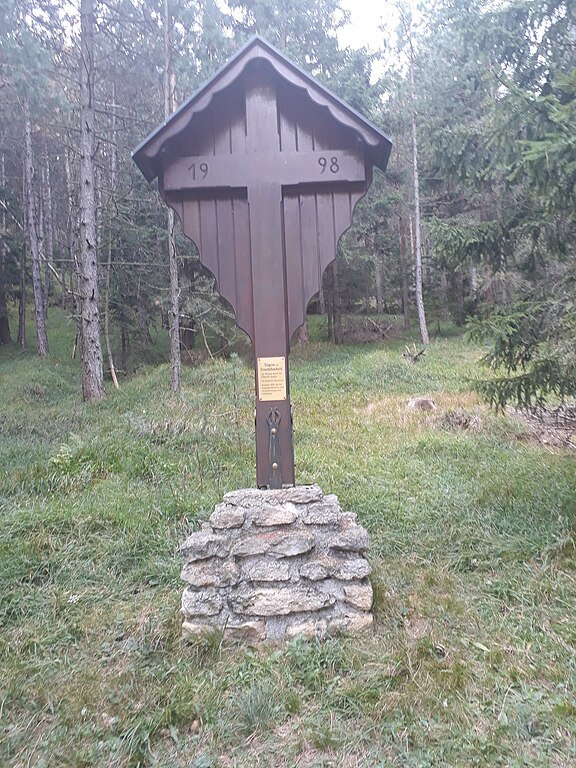
Deutsch: Dieses Kreuz steht an zwischen den Gipfeln des Heuschobers und des Geiers wo sich 5 Wanderwege kreuzen.
1. ein steiler Wanderweg von Feuchtenbach 2. ein flacher Wanderweg und Forstweg von Steinhof 3. ein anwechslungsreicher Wanderweg der meist ein Forstweg. aber auch ein Waldweg und Wanderweg von Grillenberg über das Weiße Kreuz 4. ein Wanderweg von der Hütte "Fozeben Hüte" 5. ein Wander- und Forstweg vom Waxeneck |
| Date | |
| Source | Own work |
| Author | Hannesdv |
| Camera location | | View this and other nearby images on: OpenStreetMap |
|---|
Licensing[edit]
I, the copyright holder of this work, hereby publish it under the following license:
This file is licensed under the Creative Commons Attribution-Share Alike 4.0 International license.
- You are free:
- to share – to copy, distribute and transmit the work
- to remix – to adapt the work
- Under the following conditions:
- attribution – You must give appropriate credit, provide a link to the license, and indicate if changes were made. You may do so in any reasonable manner, but not in any way that suggests the licensor endorses you or your use.
- share alike – If you remix, transform, or build upon the material, you must distribute your contributions under the same or compatible license as the original.
File history
Click on a date/time to view the file as it appeared at that time.
| Date/Time | Thumbnail | Dimensions | User | Comment | |
|---|---|---|---|---|---|
| current | 00:46, 21 October 2018 | | 3,096 × 4,128 (5.52 MB) | Hannesdv (talk | contribs) | User created page with UploadWizard |
You cannot overwrite this file.
File usage on Commons
There are no pages that use this file.