File:Kuwanoura Satsumasendai.jpg
Jump to navigation
Jump to search

Size of this preview: 539 × 599 pixels. Other resolutions: 216 × 240 pixels | 432 × 480 pixels | 691 × 768 pixels | 921 × 1,024 pixels | 1,842 × 2,048 pixels | 3,152 × 3,504 pixels.
Original file (3,152 × 3,504 pixels, file size: 2.31 MB, MIME type: image/jpeg)
Captions
Captions
Add a one-line explanation of what this file represents
Summary[edit]
| Description |
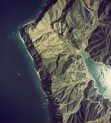
日本語: 薩摩川内市上甑町桑之浦付近の航空写真。 |
| Date | |
| Source | 国土画像情報(カラー空中写真) 国土交通省 |
| Author | 国土交通省 改変Sakoppi |
Licensing[edit]

|
The copyright holder of this file, the Ministry of Land, Infrastructure, Transport and Tourism of Japan, allows anyone to use it for any purpose, provided that the copyright holder is properly attributed. Redistribution, derivative work, commercial use, and all other use is permitted. |
Attribution:
Copyright © National Land Image Information (Color Aerial Photographs), Ministry of Land, Infrastructure, Transport and Tourism
|
 |
This image is copyrighted by the Ministry of Land, Infrastructure, Transport and Tourism of Japan. For terms of use, see the stipulation to use of National Land Information (in Japanese) and message from MLIT (in Japanese and English). When you display this image on an article, include the following phrase in the description: "Made based on National Land Image Information (Color Aerial Photographs), Ministry of Land, Infrastructure, Transport and Tourism".
|
File history
Click on a date/time to view the file as it appeared at that time.
| Date/Time | Thumbnail | Dimensions | User | Comment | |
|---|---|---|---|---|---|
| current | 07:23, 12 November 2011 | | 3,152 × 3,504 (2.31 MB) | Sakoppi (talk | contribs) | {{Information |Description ={{ja|1=薩摩川内市上甑町桑之浦付近の航空写真。}} |Source =[http://w3land.mlit.go.jp/WebGIS/ 国土画像情報(カラー空中写真)] 国土交通省 |Author |
You cannot overwrite this file.
File usage on Commons
The following page uses this file:
File usage on other wikis
The following other wikis use this file: