File:Kuyavian-Pomeranian Voivodeship location map.svg
Jump to navigation
Jump to search

Size of this PNG preview of this SVG file: 657 × 600 pixels. Other resolutions: 263 × 240 pixels | 526 × 480 pixels | 841 × 768 pixels | 1,122 × 1,024 pixels | 2,244 × 2,048 pixels | 1,100 × 1,004 pixels.
Original file (SVG file, nominally 1,100 × 1,004 pixels, file size: 1.08 MB)
Captions
Captions
Add a one-line explanation of what this file represents
Summary[edit]
| Description |
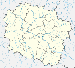
English: Location map of Kuyavian-Pomeranian Voivodeship. Geographic limits of the map:
|
| Date | |
| Source | Own work |
| Author | SANtosito |
| Other versions |
|
| SVG development |

Licensing[edit]
SANtosito, the copyright holder of this work, hereby publishes it under the following license:
This file is licensed under the Creative Commons Attribution-Share Alike 4.0 International license.
Attribution: SANtosito
- You are free:
- to share – to copy, distribute and transmit the work
- to remix – to adapt the work
- Under the following conditions:
- attribution – You must give appropriate credit, provide a link to the license, and indicate if changes were made. You may do so in any reasonable manner, but not in any way that suggests the licensor endorses you or your use.
- share alike – If you remix, transform, or build upon the material, you must distribute your contributions under the same or compatible license as the original.
File history
Click on a date/time to view the file as it appeared at that time.
| Date/Time | Thumbnail | Dimensions | User | Comment | |
|---|---|---|---|---|---|
| current | 00:19, 13 January 2021 | | 1,100 × 1,004 (1.08 MB) | SANtosito (talk | contribs) | update |
| 20:54, 14 September 2018 |  | 902 × 823 (978 KB) | SANtosito (talk | contribs) | Correct projection and borders corrected | |
| 20:07, 21 May 2018 |  | 1,525 × 1,446 (1.42 MB) | SANtosito (talk | contribs) | User created page with UploadWizard |
You cannot overwrite this file.
File usage on Commons
The following 2 pages use this file:
File usage on other wikis
The following other wikis use this file:
- Usage on de.wikipedia.org
- Zdzisław-Krzyszkowiak-Stadion
- Polonia-Bydgoszcz-Stadion
- Rudolf-Modrzejewski-Brücke
- Motoarena Toruń
- Czesław-Kobus-Stadion
- Arena Toruń
- Vorlage:Positionskarte Polen Kujawien-Pommern
- Eisenbahnbrücke Toruń
- Weichselbrücke Grudziądz
- Gen.-Elżbieta-Zawacka-Brücke
- Marek-Sudak-Brücke
- Józef-Piłsudski-Brücke
- Militärflugplatz Inowrocław-Latkowo
- Usage on en.wikipedia.org
- Brodnica
- Inowrocław
- Świecie
- Nakło nad Notecią
- Kruszwica
- Kijewo Królewskie
- Aleksandrów Kujawski
- Łabiszyn
- Koronowo
- Brześć Kujawski
- Jabłonowo Pomorskie
- Dobrzyń nad Wisłą
- Solec Kujawski
- Żnin
- Więcbork
- Płowce
- Piwnice, Kuyavian-Pomeranian Voivodeship
- Ciechocinek
- Chełmża
- Rypin
- Lipno, Lipno County
- Radziejów
- Nieszawa
- Potulice
- Barcin
- Odolion
- Strzelno
- Szubin
- Gąsawa
- Lisewo
- Nogat, Kuyavian-Pomeranian Voivodeship
- Gniewkowo
- Kcynia
- Nowe
- Mrocza
- Piotrków Kujawski
- Kamień Krajeński
View more global usage of this file.