File:Línea C4 (TUZSA).svg
Jump to navigation
Jump to search

Size of this PNG preview of this SVG file: 504 × 525 pixels. Other resolutions: 230 × 240 pixels | 461 × 480 pixels | 737 × 768 pixels | 983 × 1,024 pixels | 1,966 × 2,048 pixels.
Original file (SVG file, nominally 504 × 525 pixels, file size: 2.61 MB)
Captions
Captions
Add a one-line explanation of what this file represents

Summary
[edit].svg&action=edit§ion=1)
| Description |
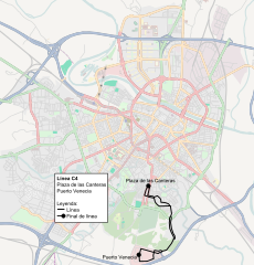
Español: Plano de la línea C4 de TUZSA |
| Date | |
| Source |
See the image in its original context on the OpenStreetMap wiki page for Zaragoza English: This map of Zaragoza was created from OpenStreetMap project data, collected by the community. This map may be incomplete, and may contain errors. Don't rely solely on it for navigation. Español: Este mapa de Zaragoza fue creado con los datos del proyecto OpenStreetMap, obtenidos por la comunidad. Este mapa puede estar incompleto, y puede contener errores. No se fíe solamente en él para las navegaciones. Français : Cette carte de Zaragoza a été créée à partir des données du projet OpenStreetMap. Cette carte est peut-être incomplète et peut contenir des erreurs. Ne vous fiez pas uniquement à elle pour vos déplacements. Italiano: Questa mappa di Zaragoza è stata creata con dati raccolti dal progetto OpenStreetMap. La mappa potrebbe essere incompleta e contenere errori. Non affidarsi esclusivamente ad essa per la navigazione.
|
| Author | OpenStreetMap contributors & user:Robot8A |
| Permission (Reusing this file) |
This file is licensed under the Creative Commons Attribution-Share Alike 2.0 Generic license.
|
Licensing
[edit].svg&action=edit§ion=2)
I, the copyright holder of this work, hereby publish it under the following licenses:

|
Permission is granted to copy, distribute and/or modify this document under the terms of the GNU Free Documentation License, Version 1.2 or any later version published by the Free Software Foundation; with no Invariant Sections, no Front-Cover Texts, and no Back-Cover Texts. A copy of the license is included in the section entitled GNU Free Documentation License. |
This file is licensed under the Creative Commons Attribution-Share Alike 4.0 International, 3.0 Unported, 2.5 Generic, 2.0 Generic and 1.0 Generic license.
- You are free:
- to share – to copy, distribute and transmit the work
- to remix – to adapt the work
- Under the following conditions:
- attribution – You must give appropriate credit, provide a link to the license, and indicate if changes were made. You may do so in any reasonable manner, but not in any way that suggests the licensor endorses you or your use.
- share alike – If you remix, transform, or build upon the material, you must distribute your contributions under the same or compatible license as the original.
You may select the license of your choice.
File history
Click on a date/time to view the file as it appeared at that time.
| Date/Time | Thumbnail | Dimensions | User | Comment | |
|---|---|---|---|---|---|
| current | 09:48, 7 October 2012 | | 504 × 525 (2.61 MB) | Robot8A (talk | contribs) | cambio de recorrido puerto venecia |
| 16:12, 26 September 2011 |  | 504 × 525 (2.61 MB) | Robot8A (talk | contribs) | {{Information |Description ={{es|1=Plano de la línea C4 de TUZSA}} |Source ={{#if: Zaragoza | See the image in its original context on the [http://wiki.openstreetmap.org/index.php/{{urlencode:Zaragoza}} OpenStreetMap wiki page for Zaragoza] | |
You cannot overwrite this file.
File usage on Commons
There are no pages that use this file.
File usage on other wikis
The following other wikis use this file:
- Usage on es.wikipedia.org
.svg&oldid=648628052)