File:LASB K Hellwig 0234.jpg
Jump to navigation
Jump to search

Size of this preview: 780 × 600 pixels. Other resolutions: 312 × 240 pixels | 625 × 480 pixels | 999 × 768 pixels | 1,280 × 984 pixels | 2,560 × 1,968 pixels | 8,196 × 6,300 pixels.
Original file (8,196 × 6,300 pixels, file size: 17.19 MB, MIME type: image/jpeg)
Captions
Captions
Add a one-line explanation of what this file represents
Summary[edit]
| Description |
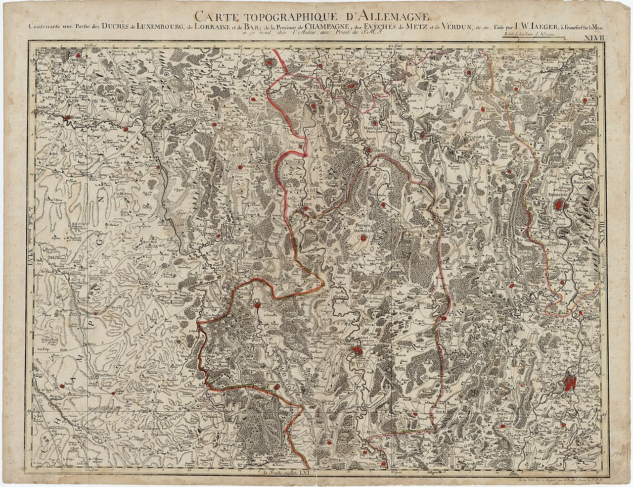
Deutsch: Topographische Deutschlandkarte: Teile Luxemburgs, Lothringens und der Champagne (CARTE TOPOGRAPHIQUE D' ALLEMAGNE Contenant une Partie des DUCHÉS de LUXEMBOURG, de LORRAINE et de BAR; de la Province de CHAMPAGNE, des EVÊCHÈS de METZ et de VERDUN, etc. etc; Faite par I. W. IAEGER, â Francfort sur le Meyn et se vend chés l' Auteur, avec Privil: de S. M. I. XLVII) - Kupferstich in altem Kolorit - französisch - ca. 1:220.000 - 52,8 x 68,7 cm - [nach 1766] |
| Date | |
| Source | Landesarchiv Saarbrücken, Kartensammlung Hellwig Nr. 234 |
| Author | Jäger, Johann Wilhelm Abraham (1718 - 1790) |
Licensing[edit]
| Media uploaded by user LandesarchivSaarbrücken are released under CC-BY-SA 3.0 DE. |
This file is licensed under the Creative Commons Attribution-Share Alike 3.0 Germany license. Attribution: Landesarchiv Saarbrücken, Bestand K Hellwig, Nr. 0234, Urheber Johann Wilhelm Abraham Jäger (1718-1790) / CC-BY-SA 3.0 DE
 |
File history
Click on a date/time to view the file as it appeared at that time.
| Date/Time | Thumbnail | Dimensions | User | Comment | |
|---|---|---|---|---|---|
| current | 08:25, 11 May 2021 | | 8,196 × 6,300 (17.19 MB) | LandesarchivSaarbrücken (talk | contribs) | Uploaded a work by Jäger, Johann Wilhelm Abraham (1718 - 1790) from Landesarchiv Saarbrücken, Kartensammlung Hellwig Nr. 234 with UploadWizard |
You cannot overwrite this file.
File usage on Commons
There are no pages that use this file.