File:LASB K Hellwig 0235.jpg
Jump to navigation
Jump to search

Size of this preview: 739 × 600 pixels. Other resolutions: 296 × 240 pixels | 592 × 480 pixels | 947 × 768 pixels | 1,262 × 1,024 pixels | 2,524 × 2,048 pixels | 7,572 × 6,144 pixels.
Original file (7,572 × 6,144 pixels, file size: 16.27 MB, MIME type: image/jpeg)
Captions
Captions
Add a one-line explanation of what this file represents
Summary[edit]
| Description |
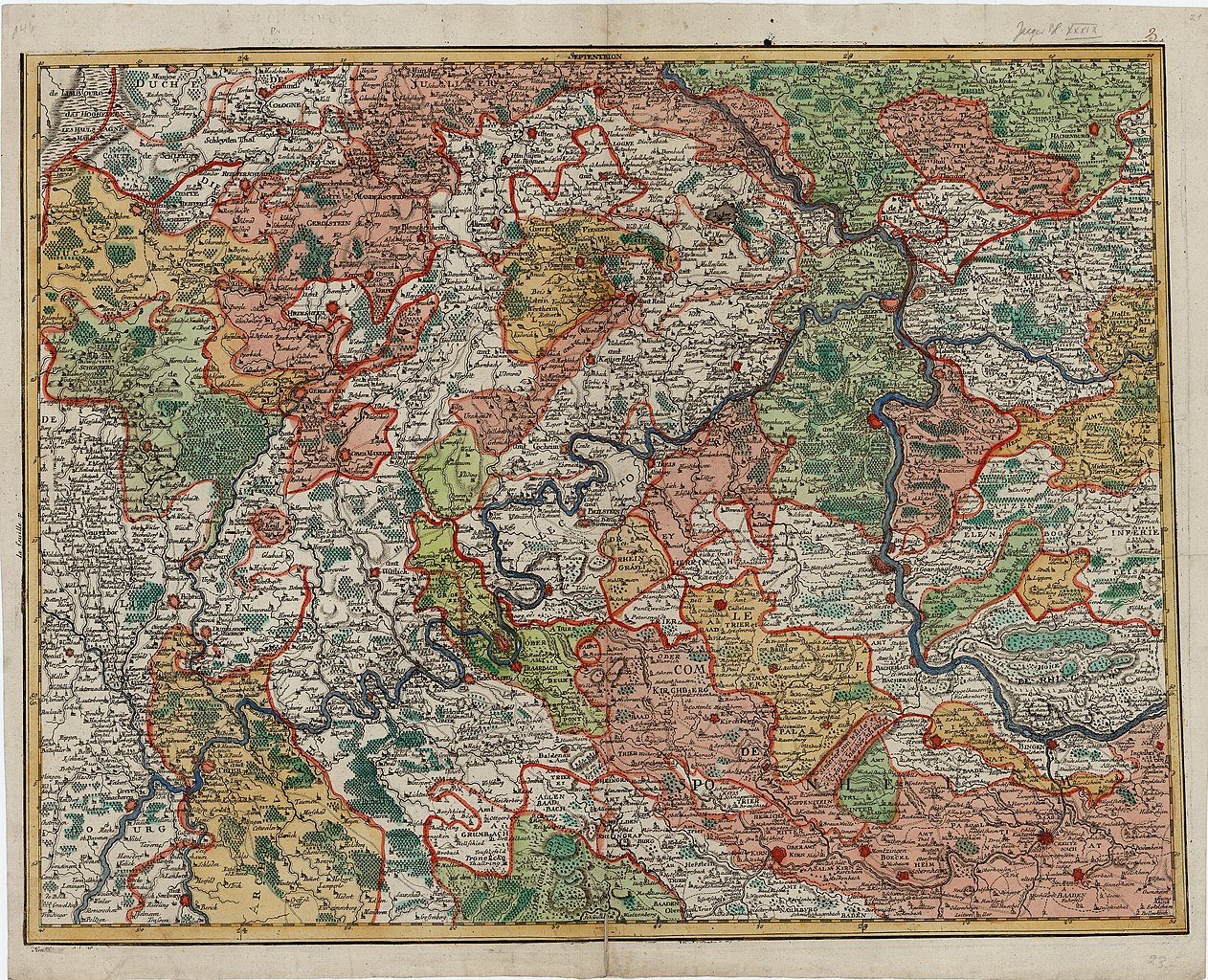
Deutsch: Topographische Deutschlandkarte: Eifel, Hunsrück, Teile Luxemburgs, Rheinhessens, des Taunus und Westerwalds - Kupferstich, koloriert - ca. 1:220.000 - 51,5 x 64,1 cm - [ca. 1785] |
| Date | |
| Source | Landesarchiv Saarbrücken, Kartensammlung Hellwig Nr. 235 |
| Author | Jäger, Johann Wilhelm Abraham (1718 - 1790) |
Licensing[edit]
| Media uploaded by user LandesarchivSaarbrücken are released under CC-BY-SA 3.0 DE. |
This file is licensed under the Creative Commons Attribution-Share Alike 3.0 Germany license. Attribution: Landesarchiv Saarbrücken, Bestand K Hellwig, Nr. 0235, Urheber Johann Wilhelm Abraham Jäger (1718-1790) / CC-BY-SA 3.0 DE
 |
File history
Click on a date/time to view the file as it appeared at that time.
| Date/Time | Thumbnail | Dimensions | User | Comment | |
|---|---|---|---|---|---|
| current | 08:27, 11 May 2021 | | 7,572 × 6,144 (16.27 MB) | LandesarchivSaarbrücken (talk | contribs) | Uploaded a work by Jäger, Johann Wilhelm Abraham (1718 - 1790) from Landesarchiv Saarbrücken, Kartensammlung Hellwig Nr. 235 with UploadWizard |
You cannot overwrite this file.
File usage on Commons
The following page uses this file: