File:LASB K Hellwig 0649.jpg
Jump to navigation
Jump to search
Size of this preview: 746 × 599 pixels. Other resolutions: 299 × 240 pixels | 598 × 480 pixels | 956 × 768 pixels | 1,275 × 1,024 pixels | 2,549 × 2,048 pixels | 6,224 × 5,000 pixels.
Original file (6,224 × 5,000 pixels, file size: 6.05 MB, MIME type: image/jpeg)
Captions
Captions
Add a one-line explanation of what this file represents
Summary[edit]
| Description |
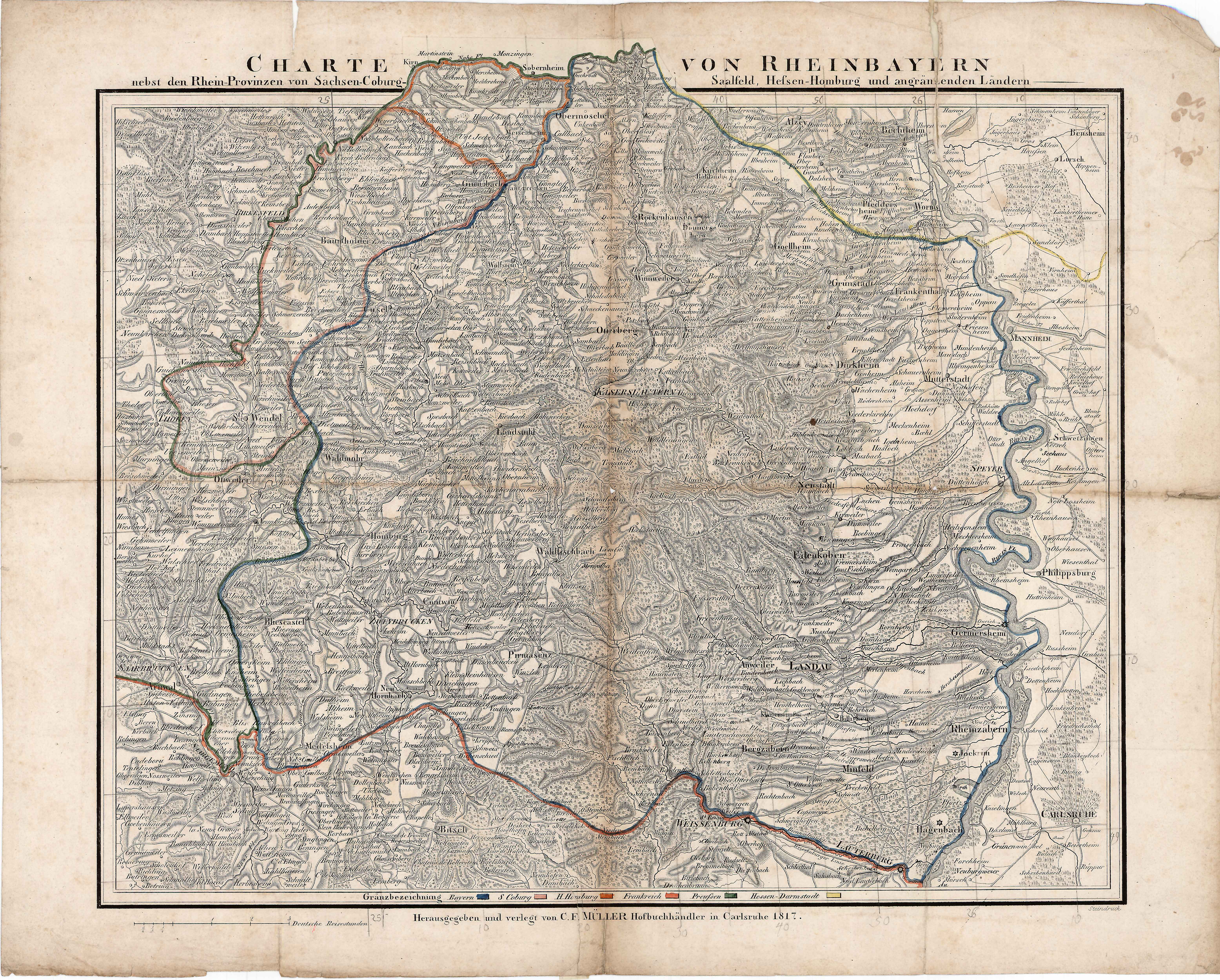
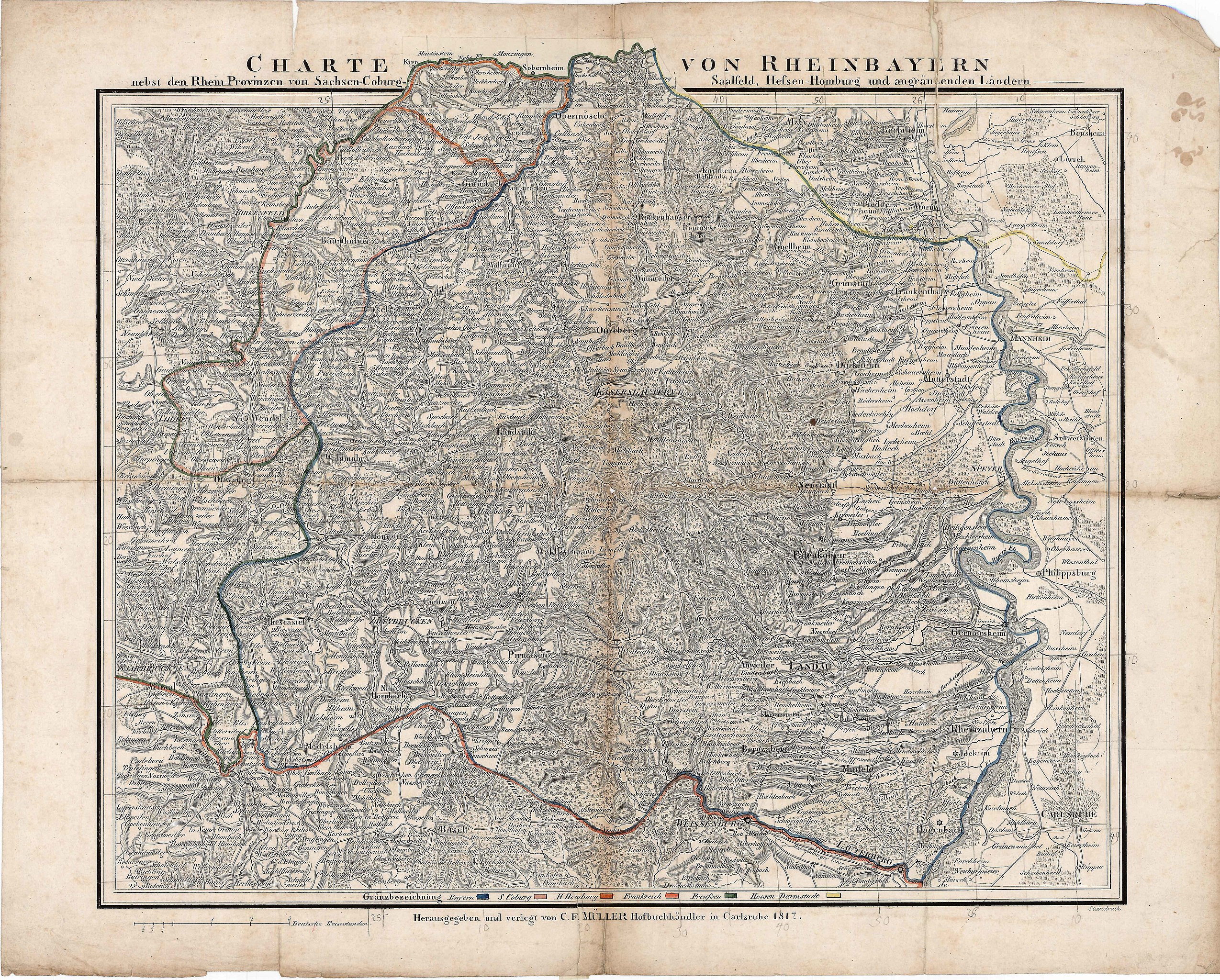
Deutsch: Karte von Rheinbayern (Rheinpfalz) und angrenzenden Territorien (CHARTE VON RHEINBAYERN nebst den Rhein-Provinzen von Sachsen-Coburg-Saalfeld, Heßen-Homburg und angränzenden Ländern) - Lithographie in altem Grenzkolorit - deutsch - 41,8 x 52,7 cm - 1817 |
| Date | |
| Source | Landesarchiv Saarbrücken, Kartensammlung Hellwig Nr. 649 |
| Author | Müller, Christian Friedrich (1776 - 1821) |
Licensing[edit]
| Media uploaded by user LandesarchivSaarbrücken are released under CC-BY-SA 3.0 DE. |
This file is licensed under the Creative Commons Attribution-Share Alike 3.0 Germany license. Attribution: Landesarchiv Saarbrücken, Bestand K Hellwig, Nr. 0649, Urheber Christian Friedrich Müller (1776-1821) / CC-BY-SA 3.0 DE
 |
File history
Click on a date/time to view the file as it appeared at that time.
| Date/Time | Thumbnail | Dimensions | User | Comment | |
|---|---|---|---|---|---|
| current | 09:05, 17 May 2021 | | 6,224 × 5,000 (6.05 MB) | LandesarchivSaarbrücken (talk | contribs) | Uploaded a work by Müller, Christian Friedrich (1776 - 1821) from Landesarchiv Saarbrücken, Kartensammlung Hellwig Nr. 649 with UploadWizard |
You cannot overwrite this file.
File usage on Commons
There are no pages that use this file.