File:Lageplan-Alt-Schieder-.jpg
Jump to navigation
Jump to search
Size of this preview: 664 × 600 pixels. Other resolutions: 266 × 240 pixels | 532 × 480 pixels | 851 × 768 pixels | 1,134 × 1,024 pixels | 1,969 × 1,778 pixels.
Original file (1,969 × 1,778 pixels, file size: 1.18 MB, MIME type: image/jpeg)
Captions
Captions
Add a one-line explanation of what this file represents
Summary
[edit]
| Description |
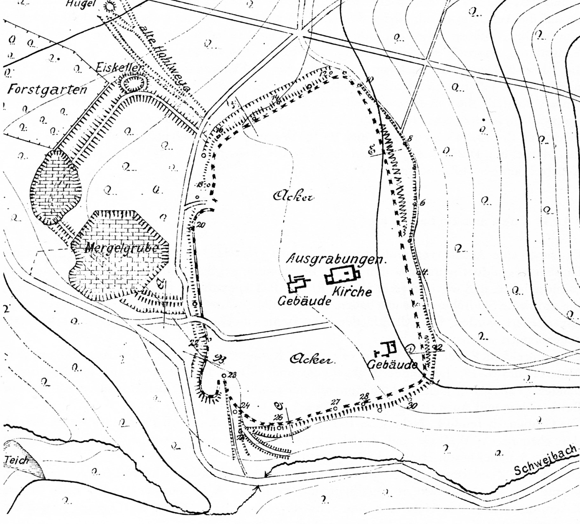
Deutsch: Alt-Schieder, Lageplan von 1916 (nach Carl Schuchhardt 1859-1943). In der Mitte die Hauptburg, oben links die Vorburg. |
| Date | |
| Source | Buch: "Atlas vorgeschichtlicher Befestigungen in Niedersachsen", Hannover 1916 |
| Author | Carl Schuchhardt |
| Permission (Reusing this file) |
PD-old-70 |
Licensing
[edit]
|
This work is in the public domain in its country of origin and other countries and areas where the copyright term is the author's life plus 70 years or fewer. | |
| This file has been identified as being free of known restrictions under copyright law, including all related and neighboring rights. | |
File history
Click on a date/time to view the file as it appeared at that time.
| Date/Time | Thumbnail | Dimensions | User | Comment | |
|---|---|---|---|---|---|
| current | 08:31, 12 October 2012 | | 1,969 × 1,778 (1.18 MB) | Oldski (talk | contribs) | {{Information |Description ={{de|1=Alt-Schieder, Lageplan von 1916 (nach Carl Schuchardt 1859-1943). In der Mitte die Hauptburg, oben links die Vorburg.}} |Source =Buch: "Atlas vorgeschichtlicher Befestigungen in Niedersachsen", Hannover 191... |
You cannot overwrite this file.
File usage on Commons
There are no pages that use this file.
File usage on other wikis
The following other wikis use this file:
- Usage on de.wikipedia.org
- Usage on ja.wikipedia.org