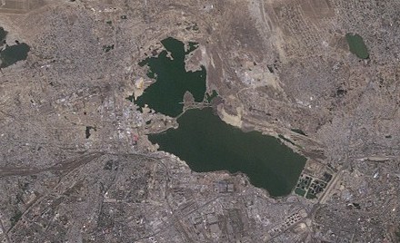
File:Lake Boyukshor (Baku, Azerbaijan, satellite image, LandSat-5, 2010-09-06, cropped).jpg
From Wikimedia Commons, the free media repository
Jump to navigation
Jump to search
Lake_Boyukshor_(Baku,_Azerbaijan,_satellite_image,_LandSat-5,_2010-09-06,_cropped).jpg (440 × 268 pixels, file size: 48 KB, MIME type: image/jpeg)
File information
Structured data
Captions
Captions
Add a one-line explanation of what this file represents
Summary[edit]
| DescriptionLake Boyukshor (Baku, Azerbaijan, satellite image, LandSat-5, 2010-09-06, cropped).jpg |
Azərbaycanca: Abşeron Yarımadası, Landsat-5 peykinin şəkili, 6 sentyabr 2010 il
English: Greater Baku, Azerbaijan, satellite image, LandSat-5, 2010-09-06, near natural colors, resolution 30 m
Русский: Спутниковая фотография Апшеронского полуострова, разрешение 30 м, 6 сентября 2010 года
Українська: Супутникова фотографія Апшеронського півострова, LandSat-5, 6 вересня 2010 року |
|||
| Date | ||||
| Source | http://edcsns17.cr.usgs.gov/NewEarthExplorer/ image ID LT51660322010249KHC01 | |||
| Author | NASA | |||
| Other versions |
|
Licensing[edit]
| Public domainPublic domainfalsefalse |
| This file is in the public domain in the United States because it was solely created by NASA. NASA copyright policy states that "NASA material is not protected by copyright unless noted". (See Template:PD-USGov, NASA copyright policy page or JPL Image Use Policy.) |  | |
 |
Warnings:
|
File history
Click on a date/time to view the file as it appeared at that time.
| Date/Time | Thumbnail | Dimensions | User | Comment | |
|---|---|---|---|---|---|
| current | 10:26, 17 January 2019 |  | 440 × 268 (48 KB) | Pticy uleteli (talk | contribs) | File:Baku, Azerbaijan, satellite image, LandSat-5, 2010-09-06.jpg cropped 90 % horizontally, 93 % vertically using CropTool with precise mode. |
You cannot overwrite this file.
File usage on Commons
The following 2 pages use this file:
File usage on other wikis
The following other wikis use this file:
- Usage on ceb.wikipedia.org
- Usage on nl.wikipedia.org
- Usage on pl.wikipedia.org
- Usage on ru.wikipedia.org
- Usage on www.wikidata.org

