File:Lake Poyang Satellite Map during May of 2012.jpg
Jump to navigation
Jump to search
Size of this preview: 532 × 599 pixels. Other resolutions: 213 × 240 pixels | 634 × 714 pixels.
Original file (634 × 714 pixels, file size: 68 KB, MIME type: image/jpeg)
Captions
Captions
Add a one-line explanation of what this file represents
Summary[edit]
| Description |
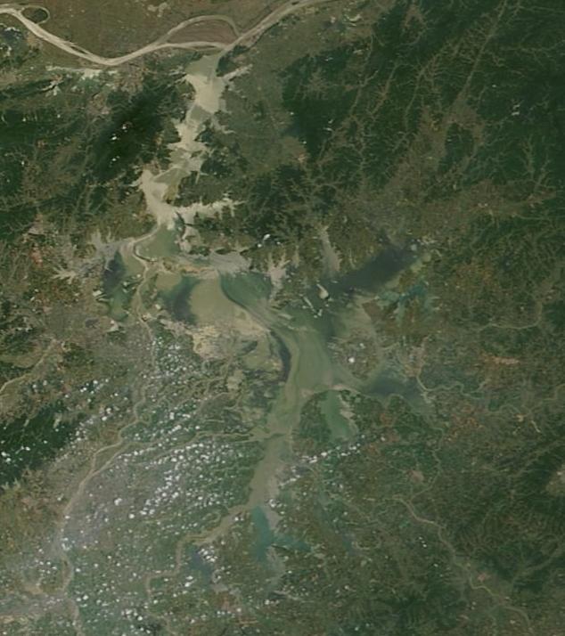
English: Satellite image of Lake Poyang, China, almost dry during January of 2014. 中文:2012年五月鄱阳湖卫星图像显示鄱阳湖水量充盈。 |
| Date | |
| Source | https://robertscribbler.wordpress.com/tag/china/ |
| Author | NASA/Lance-Modis |
Licensing[edit]
| This file is in the public domain in the United States because it was solely created by NASA. NASA copyright policy states that "NASA material is not protected by copyright unless noted". (See Template:PD-USGov, NASA copyright policy page or JPL Image Use Policy.) | ||
 |
Warnings:
|
File history
Click on a date/time to view the file as it appeared at that time.
| Date/Time | Thumbnail | Dimensions | User | Comment | |
|---|---|---|---|---|---|
| current | 14:02, 12 July 2014 | | 634 × 714 (68 KB) | 庐山里人 (talk | contribs) | User created page with UploadWizard |
You cannot overwrite this file.
File usage on Commons
There are no pages that use this file.