File:Lidingö bro 1855 2660.jpg
Jump to navigation
Jump to search

Size of this preview: 440 × 600 pixels. Other resolutions: 176 × 240 pixels | 352 × 480 pixels | 563 × 768 pixels | 751 × 1,024 pixels | 1,354 × 1,846 pixels.
Original file (1,354 × 1,846 pixels, file size: 1.14 MB, MIME type: image/jpeg)
Captions
Captions
Add a one-line explanation of what this file represents
Summary[edit]
| Description |
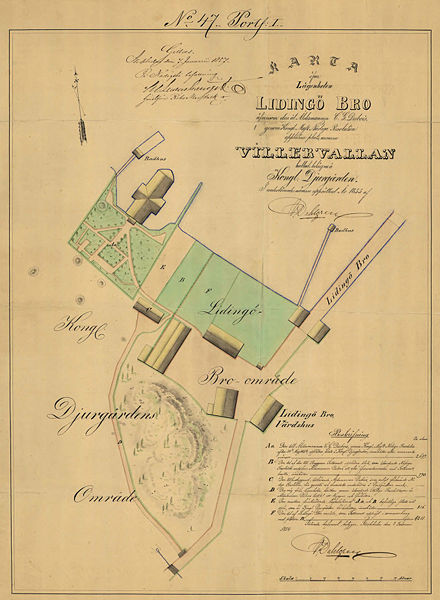
English: Historical map showing part of Kaknäs east of Djurgården, Stockholm, around Lidingöbro värdshus close to Lilla Värtan. Map created 1855.
Svenska: Historisk karta över området vid Lidingöbro värdshus invid Lilla Värtan vid Kaknäs öster om Kungl. Djurgården. Kartan skapad 1855. |
||||
| Date | |||||
| Source | Historical maps; area Kaknäs, Stockholm; Id. No. 2660 | ||||
| Author | Lidingo | ||||
| Permission (Reusing this file) |
|
||||
| This is a retouched picture, which means that it has been digitally altered from its original version. Modifications: Cropped original map image and resampled to less resolution. Modifications made by Lidingo.
|
File history
Click on a date/time to view the file as it appeared at that time.
| Date/Time | Thumbnail | Dimensions | User | Comment | |
|---|---|---|---|---|---|
| current | 13:54, 23 September 2008 | | 1,354 × 1,846 (1.14 MB) | Lidingo (talk | contribs) | {{Information |Description={{en|1=Historical map showing part of Kaknäs east of Djurgården, Stockholm, around Lidingöbro värdshus close to Lilla Värtan. Map created 1855.}} {{sv|1=Historisk karta över området vid Lidingöbro värdshus invid Lil |
You cannot overwrite this file.
File usage on Commons
The following 2 pages use this file: