File:Lincoln Sea map-ta.svg
Jump to navigation
Jump to search

Size of this PNG preview of this SVG file: 657 × 600 pixels. Other resolutions: 263 × 240 pixels | 526 × 480 pixels | 841 × 768 pixels | 1,122 × 1,024 pixels | 2,243 × 2,048 pixels | 1,000 × 913 pixels.
Original file (SVG file, nominally 1,000 × 913 pixels, file size: 199 KB)
Captions
Captions
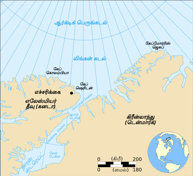
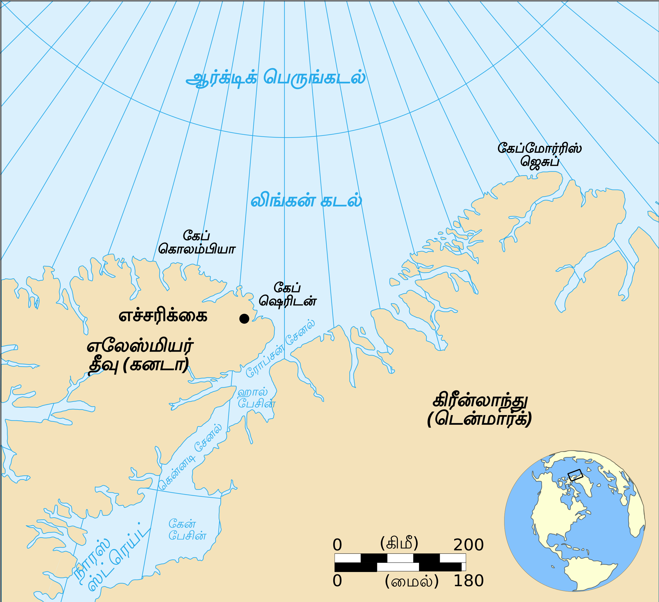
Map showing the location of the Lincoln Sea, part of the Arctic Ocean. Also shows Cape Columbia and Cape Morris Jesup : English Version
Summary[edit]
| Description |
English: Map showing the location of the Lincoln Sea, part of the Arctic Ocean. Also shows Cape Columbia and Cape Morris Jesup: English Version |
| Date | |
| Source | travail personnel made with Inkscape from Image:Lincoln Sea map.png by Pinpin |
| Author | Translated into Tamil by User:Mekala Harika |
| Other versions |
[]
|


Licensing[edit]
| This file is made available under the Creative Commons CC0 1.0 Universal Public Domain Dedication. | |
| The person who associated a work with this deed has dedicated the work to the public domain by waiving all of their rights to the work worldwide under copyright law, including all related and neighboring rights, to the extent allowed by law. You can copy, modify, distribute and perform the work, even for commercial purposes, all without asking permission.
|
File history
Click on a date/time to view the file as it appeared at that time.
| Date/Time | Thumbnail | Dimensions | User | Comment | |
|---|---|---|---|---|---|
| current | 09:34, 25 March 2019 | | 1,000 × 913 (199 KB) | Mekala Harika (talk | contribs) | User created page with UploadWizard |
You cannot overwrite this file.
File usage on Commons
The following 19 pages use this file:
- File:Lincoln Sea map-ar.png
- File:Lincoln Sea map-be.svg
- File:Lincoln Sea map-en-mr.svg
- File:Lincoln Sea map-en.svg
- File:Lincoln Sea map-eo.svg
- File:Lincoln Sea map-fr.svg
- File:Lincoln Sea map-gu.svg
- File:Lincoln Sea map-hi.svg
- File:Lincoln Sea map-kn.svg
- File:Lincoln Sea map-or.svg
- File:Lincoln Sea map-pa.svg
- File:Lincoln Sea map-ta.svg
- File:Lincoln Sea map-te.svg
- File:Lincoln Sea map as.svg
- File:Lincoln Sea map az.svg
- File:Lincoln Sea map ce.svg
- File:Lincoln Sea map ml.svg
- File:Lincoln Sea map ru.svg
- Template:Other versions/Lincoln Sea map