File:Little Hocking River map.png
Jump to navigation
Jump to search
Size of this preview: 697 × 600 pixels. Other resolutions: 279 × 240 pixels | 558 × 480 pixels | 892 × 768 pixels | 1,190 × 1,024 pixels | 2,380 × 2,048 pixels | 2,763 × 2,378 pixels.
Original file (2,763 × 2,378 pixels, file size: 6.99 MB, MIME type: image/png)
Captions
Captions
Add a one-line explanation of what this file represents
Summary[edit]
| Description |
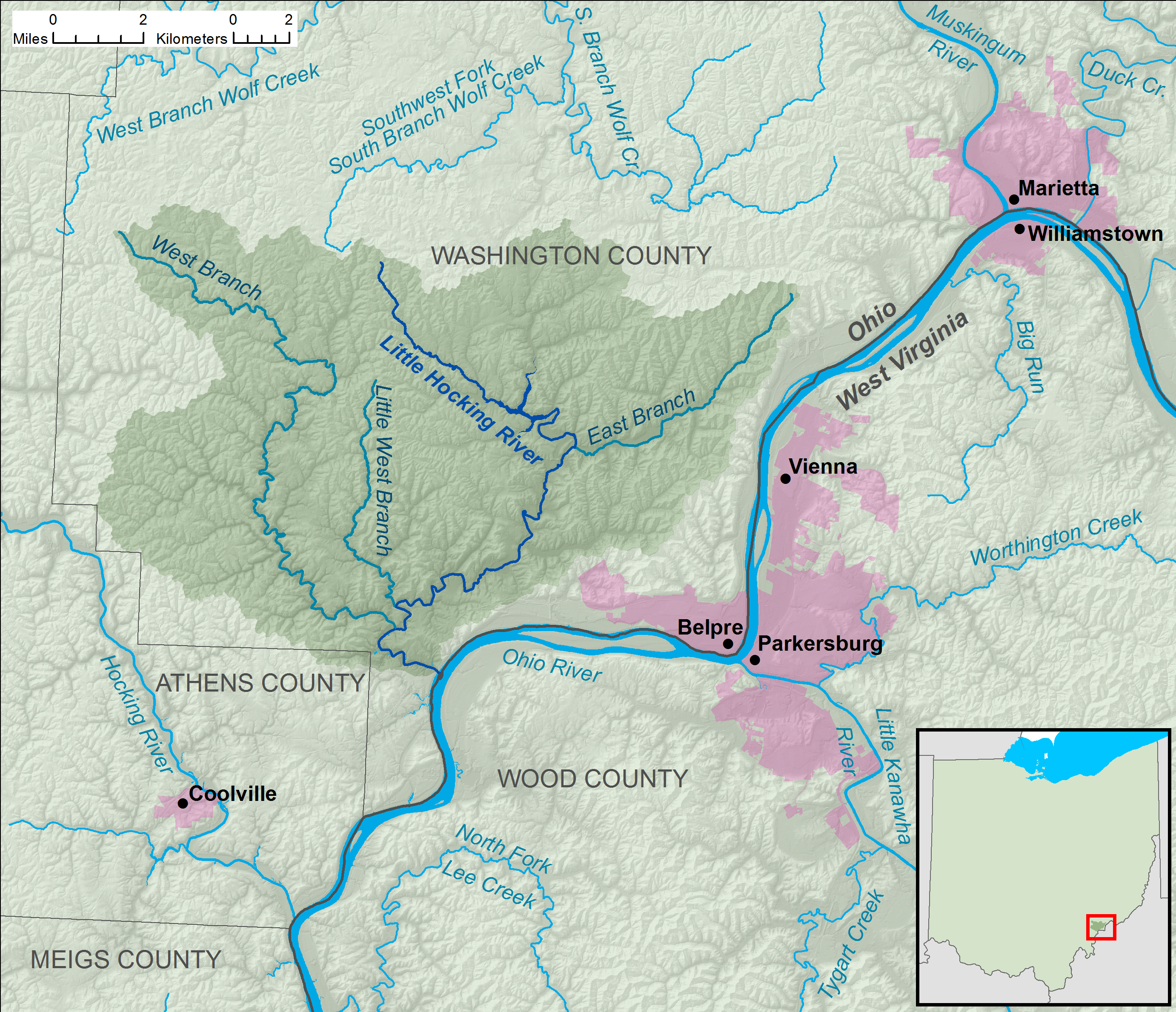
English: A map of the Little Hocking River and its watershed (USGS HUC-12 codes 050302020103, 050302020104, and 050302020105)
in Washington and Athens counties in Ohio. |
| Date | |
| Source | Own work, data from w:The National Map |
| Author | Tim Kiser (User:Malepheasant) |
Licensing[edit]
I, the copyright holder of this work, hereby publish it under the following licenses:
This file is licensed under the Creative Commons Attribution-Share Alike 3.0 Unported license.
- You are free:
- to share – to copy, distribute and transmit the work
- to remix – to adapt the work
- Under the following conditions:
- attribution – You must give appropriate credit, provide a link to the license, and indicate if changes were made. You may do so in any reasonable manner, but not in any way that suggests the licensor endorses you or your use.
- share alike – If you remix, transform, or build upon the material, you must distribute your contributions under the same or compatible license as the original.

|
Permission is granted to copy, distribute and/or modify this document under the terms of the GNU Free Documentation License, Version 1.2 or any later version published by the Free Software Foundation; with no Invariant Sections, no Front-Cover Texts, and no Back-Cover Texts. A copy of the license is included in the section entitled GNU Free Documentation License. |
You may select the license of your choice.
File history
Click on a date/time to view the file as it appeared at that time.
| Date/Time | Thumbnail | Dimensions | User | Comment | |
|---|---|---|---|---|---|
| current | 05:48, 28 November 2013 | | 2,763 × 2,378 (6.99 MB) | TimK MSI (talk | contribs) | redesign with topography, scale bar, additional labels |
| 02:13, 5 June 2013 |  | 2,763 × 2,378 (224 KB) | TimK MSI (talk | contribs) | {{Information |Description ={{en|1=A map of the Little Hocking River and its watershed (USGS HUC-12 codes 050302020103, 050302020104, and 050302020105) in Washington and Athens countie... |
You cannot overwrite this file.
File usage on Commons
There are no pages that use this file.
File usage on other wikis
The following other wikis use this file:
- Usage on en.wikipedia.org
- Usage on zh.wikipedia.org