File:Londres1888.jpg

Original file (4,132 × 2,909 pixels, file size: 1.85 MB, MIME type: image/jpeg)
Captions
Captions
| Description |
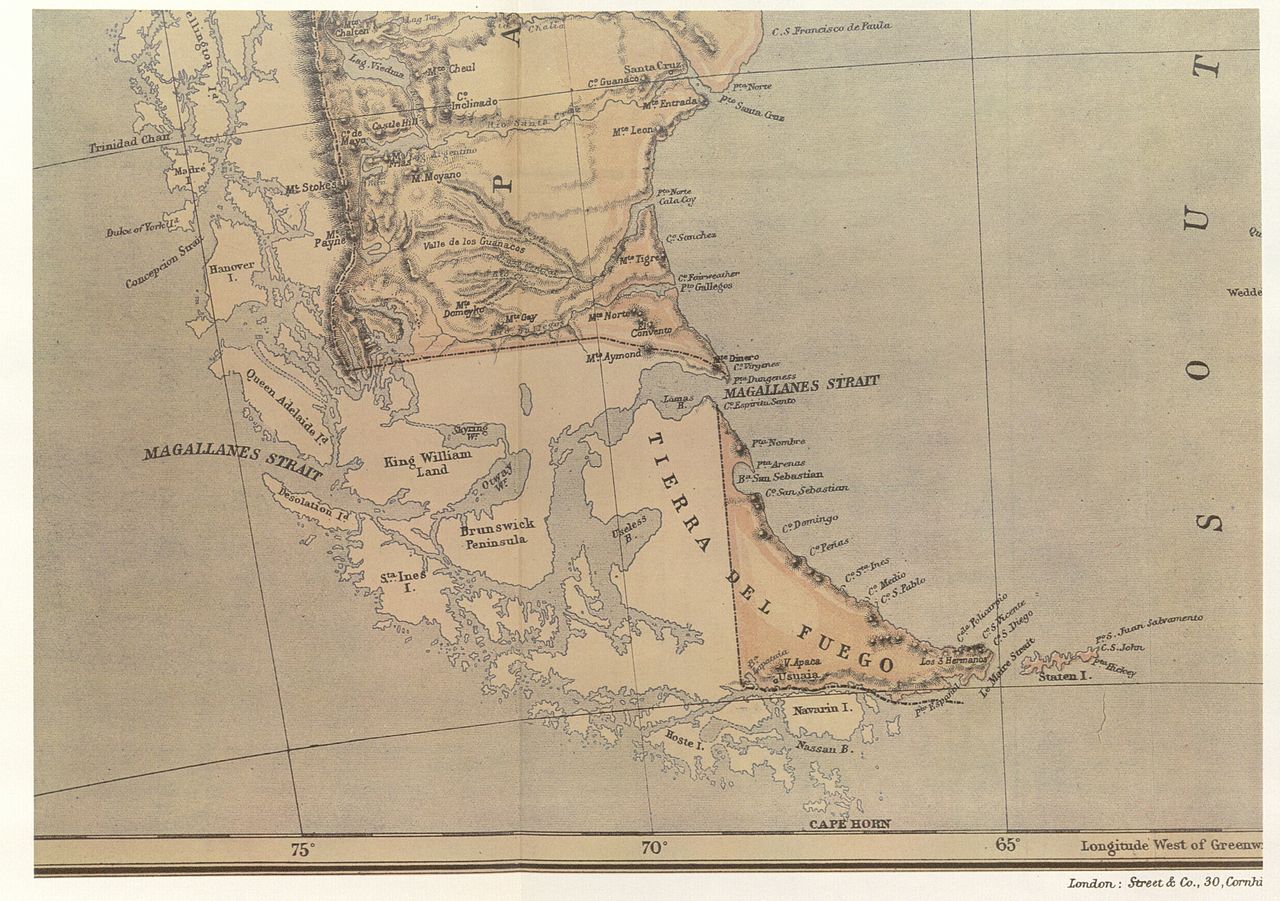
Map from the Argentine Government Information Office in the capital of Great Britain. That office was a branch of the Agentine Ministry for Foreign Affairs and Workship. The maps shows the international boundary passing through the centre of the Beagle Channel and continuing beyond its eastern mouth, and indicates Picton, Nueva and Lennox Islands and all the other islands and islets extending southwards as far as Cape Horn as being under Chilean sovereingty |
||||
| Date | |||||
| Source | El Conflicto del Beagle, edited by the Chilean Foreign Affairs Office, 1978, Switzerland. | ||||
| Author | Unknown author | ||||
| Permission (Reusing this file) |
|
||||
File history
Click on a date/time to view the file as it appeared at that time.
| Date/Time | Thumbnail | Dimensions | User | Comment | |
|---|---|---|---|---|---|
| current | 00:23, 6 November 2007 | | 4,132 × 2,909 (1.85 MB) | Keysanger (talk | contribs) | {{Information |Description=Map from the Argentine Government Information Office in the capital of Great Britain. That office was a branch of the Agentine Ministry for Foreign Affairs and Workship. The maps shows the international boundary passing through |
You cannot overwrite this file.
File usage on Commons
There are no pages that use this file.