File:Los Lagos location map.svg
Jump to navigation
Jump to search

Size of this PNG preview of this SVG file: 200 × 276 pixels. Other resolutions: 174 × 240 pixels | 348 × 480 pixels | 556 × 768 pixels | 742 × 1,024 pixels | 1,484 × 2,048 pixels.
Original file (SVG file, nominally 200 × 276 pixels, file size: 931 KB)
Captions
Captions
Add a one-line explanation of what this file represents
Summary[edit]
| Description |
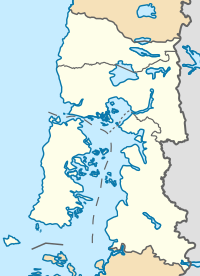
Location map infoː |
| Date | |
| Source |
This file was derived from: Chile location map.svg by NordNordWest |
| Author |
|
Licensing[edit]
This file is licensed under the Creative Commons Attribution-ShareAlike 3.0 Chile license.
- You are free:
- to share – to copy, distribute and transmit the work
- to remix – to adapt the work
- Under the following conditions:
- attribution – You must give appropriate credit, provide a link to the license, and indicate if changes were made. You may do so in any reasonable manner, but not in any way that suggests the licensor endorses you or your use.
- share alike – If you remix, transform, or build upon the material, you must distribute your contributions under the same or compatible license as the original.

File history
Click on a date/time to view the file as it appeared at that time.
| Date/Time | Thumbnail | Dimensions | User | Comment | |
|---|---|---|---|---|---|
| current | 21:01, 22 October 2017 | | 200 × 276 (931 KB) | Janitoalevic (talk | contribs) | Límites más precisos. |
| 19:32, 16 July 2016 |  | 200 × 276 (1.04 MB) | Janitoalevic (talk | contribs) | Added maritime border of Palena Province. | |
| 18:44, 12 July 2016 |  | 200 × 276 (1.04 MB) | Janitoalevic (talk | contribs) | User created page with UploadWizard |
You cannot overwrite this file.
File usage on Commons
The following page uses this file:
File usage on other wikis
The following other wikis use this file:
- Usage on ar.wikipedia.org
- Usage on de.wikipedia.org
- Osorno
- Lago Llanquihue
- Frutillar
- Puerto Octay
- Puerto Varas
- Lago Rupanco
- Estadio Regional de Chinquihue
- Chaitén (Vulkan)
- Wikipedia:Kartenwerkstatt/Positionskarten/Südamerika
- Lago Chapo
- Mechuque
- Yate (Vulkan)
- Vorlage:Positionskarte/Rahmen
- Paso Fronterizo Cardenal Samoré
- Chiloé-Archipel
- Vorlage:Positionskarte/Rahmen/Doku
- Lago Todos los Santos
- Reloncaví-Fjord
- Michinmahuida
- Kraftwerk Canutillar
- Vorlage:Positionskarte Chile Los Lagos
- Saltos de Petrohué
- Golf von Corcovado
- Futaleufú (Kommune)
- Golf von Ancud
- Estadio Municipal Rubén Marcos Peralta
- Usage on en.wikipedia.org
- Todos los Santos Lake
- Rupanco Lake
- Puyehue Lake
- Puyehue Hot Springs
- Calbuco Channel
- Calbuco Island
- Church of Santa María de Loreto, Achao
- Church of San Juan Bautista, Dalcahue
- Church of San Francisco, Castro
- Church of Our Lady of Sorrows, Dalcahue
- Church of Caguach
- Church of Quinchao
- Church of Nercón
- Church of Chelín
- Church of Colo
- Church of Rilán
- Church of Aldachildo
- Church of Ichuac
- Church of Detif
View more global usage of this file.