File:Lubowidz (gmina) location map.png
Jump to navigation
Jump to search

Size of this preview: 696 × 599 pixels. Other resolutions: 279 × 240 pixels | 558 × 480 pixels | 892 × 768 pixels | 1,158 × 997 pixels.
Original file (1,158 × 997 pixels, file size: 118 KB, MIME type: image/png)
Captions
Captions
Add a one-line explanation of what this file represents
| Description |
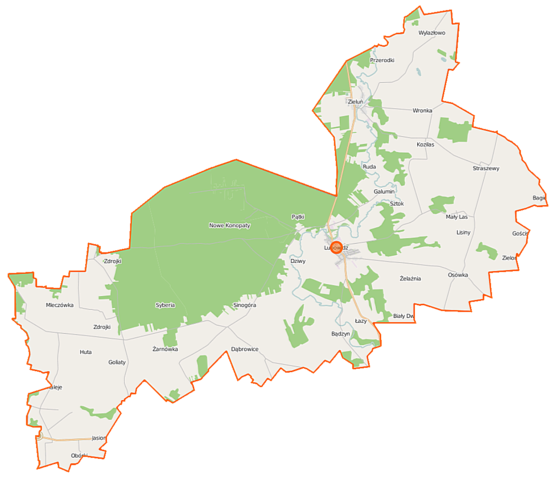
Polski: Mapa gminy Lubowidz, Polska
English: Map of Gmina Lubowidz, Poland |
|||||||||
| Date | ||||||||||
| Source | You may find a page on the OpenStreetMap wiki page for Lubowidz (gmina) | |||||||||
| Creator |
OpenStreetMap contributors OpenStreetMap contributors |
|||||||||
| Permission (Reusing this file) |
OpenStreetMap data is available under the Open Database License (details). Map tiles are licensed under the Creative Commons Attribution-ShareAlike 2.0 license (CC-BY-SA 2.0).
This file is licensed under the Creative Commons Attribution-Share Alike 2.0 Generic license.
|
|||||||||
| Geotemporal data | ||||||||||
| Bounding box |
|
|||||||||
| Georeferencing | If inappropriate please set warp_status = skip to hide. | |||||||||
File history
Click on a date/time to view the file as it appeared at that time.
| Date/Time | Thumbnail | Dimensions | User | Comment | |
|---|---|---|---|---|---|
| current | 11:49, 18 October 2014 | | 1,158 × 997 (118 KB) | VanWiel (talk | contribs) | {{OpenStreetMap | name = Lubowidz (gmina) | location = Lubowidz (gmina) | description = {{pl|Mapa gminy Lubowidz, Polska}} {{en|Map of Gmina Lubowidz, Poland}} | top = 53.2153 | left = 19.6291 | r... |
You cannot overwrite this file.
File usage on Commons
There are no pages that use this file.
File usage on other wikis
The following other wikis use this file:
- Usage on fr.wikipedia.org
- Usage on pl.wikipedia.org
- Zieluń
- Zieluń-Osada
- Lubowidz (gmina)
- Bądzyn
- Cieszki
- Dziwy
- Galumin
- Goliaty
- Jasiony
- Kipichy
- Konopaty
- Kozilas
- Mały Las
- Mleczówka
- Pątki
- Przerodki
- Purzyce
- Sinogóra
- Sztok
- Straszewy
- Toruniak
- Wylazłowo (województwo mazowieckie)
- Żelaźnia
- Zatorowizna
- Zdrojki (województwo mazowieckie)
- Lisiny (województwo mazowieckie)
- Lubowidz
- Płociczno (województwo mazowieckie)
- Rynowo (województwo mazowieckie)
- Suchy Grunt (województwo mazowieckie)
- Wronka (województwo mazowieckie)
- Huta (powiat żuromiński)
- Łazy (powiat żuromiński)
- Obórki (powiat żuromiński)
- Osówka (powiat żuromiński)
- Ruda (powiat żuromiński)
- Syberia (powiat żuromiński)
- Żarnówka (powiat żuromiński)
- Kaleje (województwo mazowieckie)
- Biały Dwór (województwo mazowieckie)
- Majdany-Leśniczówka
- Ośniak
- Pieńki (Pątki)
- Kosmal (Przerodki)
- Kurzyska (Ruda)
- Psota (Sinogóra)
- Rozwozinek
- Wapniska (Syberia)
- Kresy (Zatorowizna)
View more global usage of this file.
_location_map.png)
_location_map.png&oldid=519976229)