File:Lunar South Pole Terrain in Coded Color (SVS5127 - lola colorbar print).jpg
Jump to navigation
Jump to search

No higher resolution available.
Lunar_South_Pole_Terrain_in_Coded_Color_(SVS5127_-_lola_colorbar_print).jpg (572 × 71 pixels, file size: 19 KB, MIME type: image/jpeg)
Captions
Captions
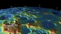
The colors used to show elevation at the South Pole of the Moon.
Summary
[edit]| Description |
English: The colors used to show elevation at the South Pole of the Moon. |
| Date | 22 July 2023 (upload date) |
| Source | Lunar South Pole Terrain in Coded Color |
| Author | NASA's Scientific Visualization Studio - Ernie Wright, Alex Kekesi, Noah Petro, David Ladd, Ian Jones, Laurence Schuler |
| Other versions |
|
| Keywords | South Pole; Craters; Solar System; Moon; 4K; Hyperwall; LRO; LOLA; Lunar Reconnaissance Orbiter; HDTV; Topographical Map |
.jpg&action=edit§ion=1)
Licensing
[edit].jpg&action=edit§ion=2)
| This file is in the public domain in the United States because it was solely created by NASA. NASA copyright policy states that "NASA material is not protected by copyright unless noted". (See Template:PD-USGov, NASA copyright policy page or JPL Image Use Policy.) | ||
 |
Warnings:
|
File history
Click on a date/time to view the file as it appeared at that time.
| Date/Time | Thumbnail | Dimensions | User | Comment | |
|---|---|---|---|---|---|
| current | 08:45, 21 March 2024 | 572 × 71 (19 KB) | Arlo Barnes (talk | contribs) | Cropped 55 % horizontally, 80 % vertically using CropTool with lossless mode. | |
| 08:49, 5 September 2023 | 1,280 × 360 (31 KB) | OptimusPrimeBot (talk | contribs) | #Spacemedia - Upload of https://svs.gsfc.nasa.gov/vis/a000000/a005100/a005127/lola_colorbar_print.jpg via Commons:Spacemedia |
You cannot overwrite this file.
File usage on Commons
The following page uses this file:
.jpg&oldid=867984383)