File:Lurish Language Map.png
Jump to navigation
Jump to search
No higher resolution available.
Lurish_Language_Map.png (512 × 443 pixels, file size: 91 KB, MIME type: image/png)
Captions
Captions
Add a one-line explanation of what this file represents
Summary[edit]
| Description |
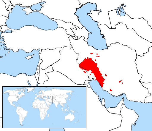
English: self-made based on a map in "Lurs" book page 74-73. |
| Date | |
| Source |
Own work |
| Author | Ffiadd |
Licensing[edit]
I, the copyright holder of this work, hereby publish it under the following license:
This file is licensed under the Creative Commons Attribution-Share Alike 3.0 Unported license.
- You are free:
- to share – to copy, distribute and transmit the work
- to remix – to adapt the work
- Under the following conditions:
- attribution – You must give appropriate credit, provide a link to the license, and indicate if changes were made. You may do so in any reasonable manner, but not in any way that suggests the licensor endorses you or your use.
- share alike – If you remix, transform, or build upon the material, you must distribute your contributions under the same or compatible license as the original.
File history
Click on a date/time to view the file as it appeared at that time.
| Date/Time | Thumbnail | Dimensions | User | Comment | |
|---|---|---|---|---|---|
| current | 16:11, 4 October 2022 | | 512 × 443 (91 KB) | Eidiporia2 (talk | contribs) | Kurdish areas based on resourced maps: https://www.facinghistory.org/resource-library/kurdish-inhabited-area _ https://en.wikipedia.org/wiki/File:Kurdish-inhabited_area_by_CIA_(1992)_box_inset_removed.jpg __ https://www.the-american-interest.com/wp-content/uploads/2013/12/Kurdish-inhabited-area.png __ https://commons.wikimedia.org/wiki/File:Kurdish-inhabited_areas_of_the_Middle_East_and_the_Soviet_Union_in_1986.jpg __ https://www.britannica.com/topic/Kurd __ https://www.researchgate.net/f... |
| 10:09, 23 September 2022 |  | 512 × 442 (93 KB) | Vajd (talk | contribs) | Removal of kurdish sections according to: https://fa.m.wikipedia.org/wiki/%DA%A9%D8%B1%D8%AF%DB%8C_%D8%A7%DB%8C%D9%84%D8%A7%D9%85%DB%8C https://www.researchgate.net/figure/Map-of-Ilam-Province-Iran-summarizing-local-perceptions-of-language-distribution_fig2_264347133 | |
| 15:21, 27 July 2022 |  | 512 × 443 (91 KB) | Eidiporia2 (talk | contribs) | Reverted to version as of 10:56, 14 September 2016 (UTC) | |
| 19:45, 25 July 2022 |  | 512 × 442 (93 KB) | Vajd (talk | contribs) | Removal of kurdish areas | |
| 10:56, 14 September 2016 |  | 512 × 443 (91 KB) | Hosseiniran (talk | contribs) | new map | |
| 10:06, 16 January 2014 |  | 512 × 443 (94 KB) | Ffiadd (talk | contribs) | User created page with UploadWizard |
You cannot overwrite this file.
File usage on Commons
There are no pages that use this file.
File usage on other wikis
The following other wikis use this file:
- Usage on af.wikipedia.org
- Usage on azb.wikipedia.org
- Usage on ca.wikipedia.org
- Usage on ckb.wikipedia.org
- Usage on de.wikipedia.org
- Usage on eo.wikipedia.org
- Usage on es.wikipedia.org
- Usage on fa.wikipedia.org
- Usage on fr.wikipedia.org
- Usage on hr.wikipedia.org
- Usage on hy.wikipedia.org
- Usage on incubator.wikimedia.org
- Usage on ku.wikipedia.org
- Usage on lrc.wikipedia.org
- Usage on nl.wikipedia.org
- Usage on pl.wikipedia.org
- Usage on pt.wikipedia.org
- Usage on ru.wikipedia.org
- Usage on sh.wikipedia.org
- Usage on uk.wikipedia.org
- Usage on zh.wikipedia.org