File:M66 motorway in 1998 in North West England map.svg
Jump to navigation
Jump to search

Size of this PNG preview of this SVG file: 393 × 565 pixels. Other resolutions: 167 × 240 pixels | 334 × 480 pixels | 534 × 768 pixels | 712 × 1,024 pixels | 1,424 × 2,048 pixels.
Original file (SVG file, nominally 393 × 565 pixels, file size: 418 KB)
Captions
Captions
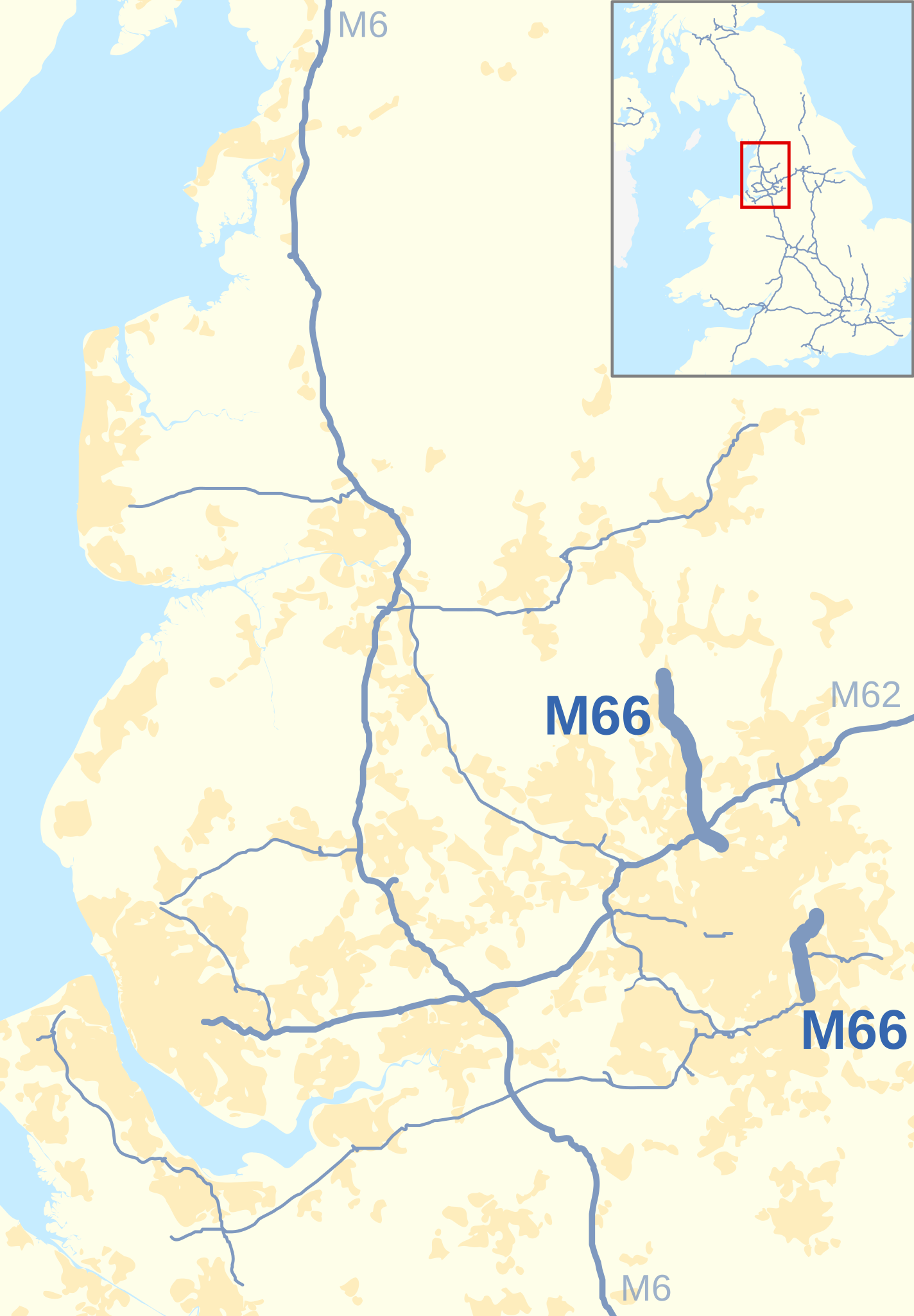
Historical map of M66 motorway in 1998
Summary[edit]
| Description |
English: Historical map of the M66 motorway of Great Britain highlighted against the motorways of North West England in 1998.
Equirectangular map projection on WGS 84 datum. |
| Date | |
| Source |
This file was derived from:  Motorways in North West England map.svg Motorways in North West England map.svg |
| Author | |
| Other versions |
M66 motorway in North West England map.svg:  for 2016 map for 2016 map |
Licensing[edit]
| This work contains information from OpenStreetMap, which is made available under the Open Database License (ODbL).
The ODbL does not require any particular license for maps produced from ODbL data. Prior to 1 August 2020, map tiles produced by the OpenStreetMap Foundation were licensed under the CC-BY-SA-2.0 license. Maps produced by other people may be subject to other licences. |
This file is licensed under the Creative Commons Attribution-Share Alike 4.0 International license.
Attribution: Nilfanion and Dr Greg. © OpenStreetMap contributors. Contains Ordnance Survey data © Crown copyright and database right 2010.
- You are free:
- to share – to copy, distribute and transmit the work
- to remix – to adapt the work
- Under the following conditions:
- attribution – You must give appropriate credit, provide a link to the license, and indicate if changes were made. You may do so in any reasonable manner, but not in any way that suggests the licensor endorses you or your use.
- share alike – If you remix, transform, or build upon the material, you must distribute your contributions under the same or compatible license as the original.
File history
Click on a date/time to view the file as it appeared at that time.
| Date/Time | Thumbnail | Dimensions | User | Comment | |
|---|---|---|---|---|---|
| current | 13:31, 2 May 2022 | | 393 × 565 (418 KB) | Dr Greg (talk | contribs) | correction of small cosmetic error |
| 13:25, 2 May 2022 |  | 393 × 565 (418 KB) | Dr Greg (talk | contribs) | Uploaded a work by * ''Motorways in North West England map.svg'': Dr Greg and Nilfanion, created using Ordnance Survey and OpenStreetMap data * derivative work: Dr Greg from {{Derived from |Motorways in North West England map.svg |display=50 |opt=l}} with UploadWizard |
You cannot overwrite this file.
File usage on Commons
The following 3 pages use this file:
File usage on other wikis
The following other wikis use this file:
- Usage on en.wikipedia.org