File:MH370 location probability heat map per DST Group analysis.jpg
Jump to navigation
Jump to search
Size of this preview: 800 × 566 pixels. Other resolutions: 320 × 226 pixels | 640 × 453 pixels | 1,024 × 724 pixels | 1,280 × 905 pixels | 1,500 × 1,061 pixels.
Original file (1,500 × 1,061 pixels, file size: 384 KB, MIME type: image/jpeg)
Captions
Captions
Add a one-line explanation of what this file represents
Summary[edit]
| Description |
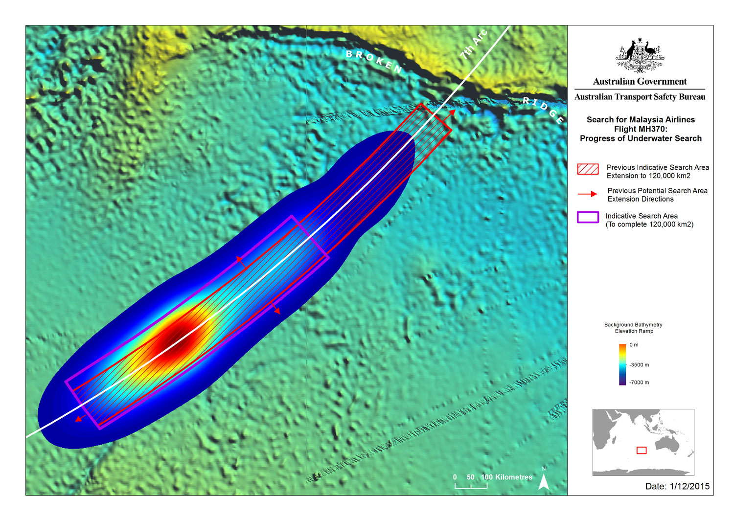
English: Probability of the location where Malaysia Airlines Flight 370 entered the ocean, based on an analysis by the Australian Defence and Science Technology Group (DST Group) and released on 3 December 2015. |
| Date | |
| Source | [1] |
| Author | Australian Transport Safety Bureau |
![[1]](http://jacc.gov.au/media/maps/files/20151201_IndicativeArea_Bathy_DSTO_HeatMap_A4.jpg)
Licensing[edit]
This file is licensed under the Creative Commons Attribution 3.0 Australia license.
- You are free:
- to share – to copy, distribute and transmit the work
- to remix – to adapt the work
- Under the following conditions:
- attribution – You must give appropriate credit, provide a link to the license, and indicate if changes were made. You may do so in any reasonable manner, but not in any way that suggests the licensor endorses you or your use.

File history
Click on a date/time to view the file as it appeared at that time.
| Date/Time | Thumbnail | Dimensions | User | Comment | |
|---|---|---|---|---|---|
| current | 05:06, 3 December 2015 | | 1,500 × 1,061 (384 KB) | AHeneen (talk | contribs) | User created page with UploadWizard |
You cannot overwrite this file.
File usage on Commons
The following page uses this file:
File usage on other wikis
The following other wikis use this file:
- Usage on cs.wikipedia.org
- Usage on de.wikipedia.org
- Usage on en.wikipedia.org
- Usage on es.wikipedia.org
- Usage on fa.wikipedia.org
- Usage on fr.wikipedia.org
- Usage on he.wikipedia.org
- Usage on it.wikipedia.org
- Usage on ja.wikipedia.org
- Usage on tr.wikipedia.org
- Usage on zh-yue.wikipedia.org
- Usage on zh.wikipedia.org