File:Malwa Subah.png
Original file (1,402 × 1,286 pixels, file size: 3.17 MB, MIME type: image/png)
Captions
Captions
Summary[edit]
| Description |
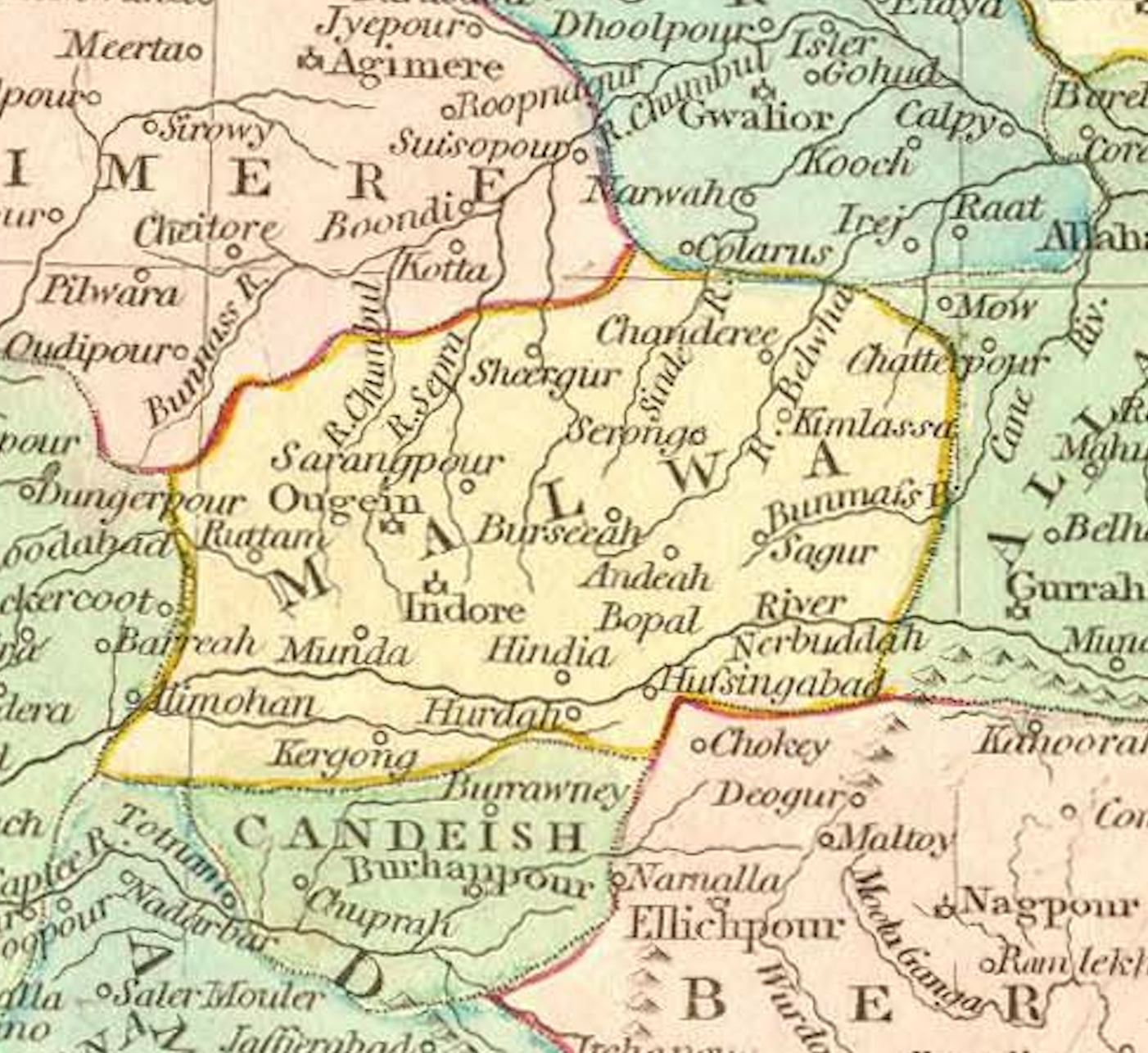
English: Malwa Subah of the Mughal Empire, established in 1596.
Cropped image of original map under title 'Hindoostan Divided into Soubahs according to the Ayin Acbaree.' Originally published in: 'Wilkinson's General Atlas of the World, Quarters, Empires, Kingdoms, States &c. with Appropriate Tables. Second Edition. London. Published March 1, 1809, by Rob't Wilkinson, No. 125' Has title page from the 1809 edition. Table of Contents has date of 1805. Maps are hand painted in full color. Thumbnail scanned map image taken from URL: http://www.columbia.edu/itc/mealac/pritchett/00maplinks/colonial/wilkinsonmaps/ainakbarimap/ainakbarimap.html Zoomable map (higher-quality) available at: https://mediacommons.unl.edu/luna/servlet/s/0byw61 |
| Date | c. 1805 |
| Source | http://www.columbia.edu/itc/mealac/pritchett/00maplinks/mughal/mughal_index.html |
| Author | Wilkinson, Robert |
Licensing[edit]
|
This work is in the public domain in its country of origin and other countries and areas where the copyright term is the author's life plus 70 years or fewer. This work is in the public domain in the United States because it was published (or registered with the U.S. Copyright Office) before January 1, 1929. | |
| This file has been identified as being free of known restrictions under copyright law, including all related and neighboring rights. | |
File history
Click on a date/time to view the file as it appeared at that time.
| Date/Time | Thumbnail | Dimensions | User | Comment | |
|---|---|---|---|---|---|
| current | 21:44, 1 September 2022 | | 1,402 × 1,286 (3.17 MB) | MaplesyrupSushi (talk | contribs) | Uploaded a work by Wilkinson, Robert from http://www.columbia.edu/itc/mealac/pritchett/00maplinks/mughal/mughal_index.html with UploadWizard |
You cannot overwrite this file.
File usage on Commons
The following page uses this file:
File usage on other wikis
The following other wikis use this file:
- Usage on en.wikipedia.org
- Usage on ko.wikipedia.org