File:Map Amakusa en.svg
Jump to navigation
Jump to search

Size of this PNG preview of this SVG file: 653 × 600 pixels. Other resolutions: 261 × 240 pixels | 523 × 480 pixels | 836 × 768 pixels | 1,115 × 1,024 pixels | 2,230 × 2,048 pixels | 1,226 × 1,126 pixels.
Original file (SVG file, nominally 1,226 × 1,126 pixels, file size: 50 KB)
Captions
Captions
Add a one-line explanation of what this file represents
Summary[edit]
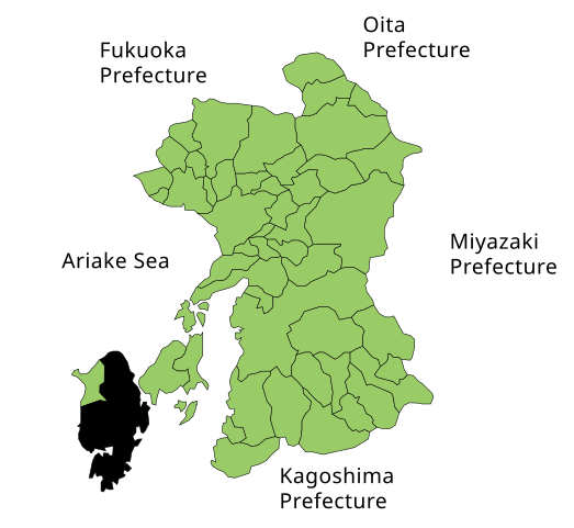
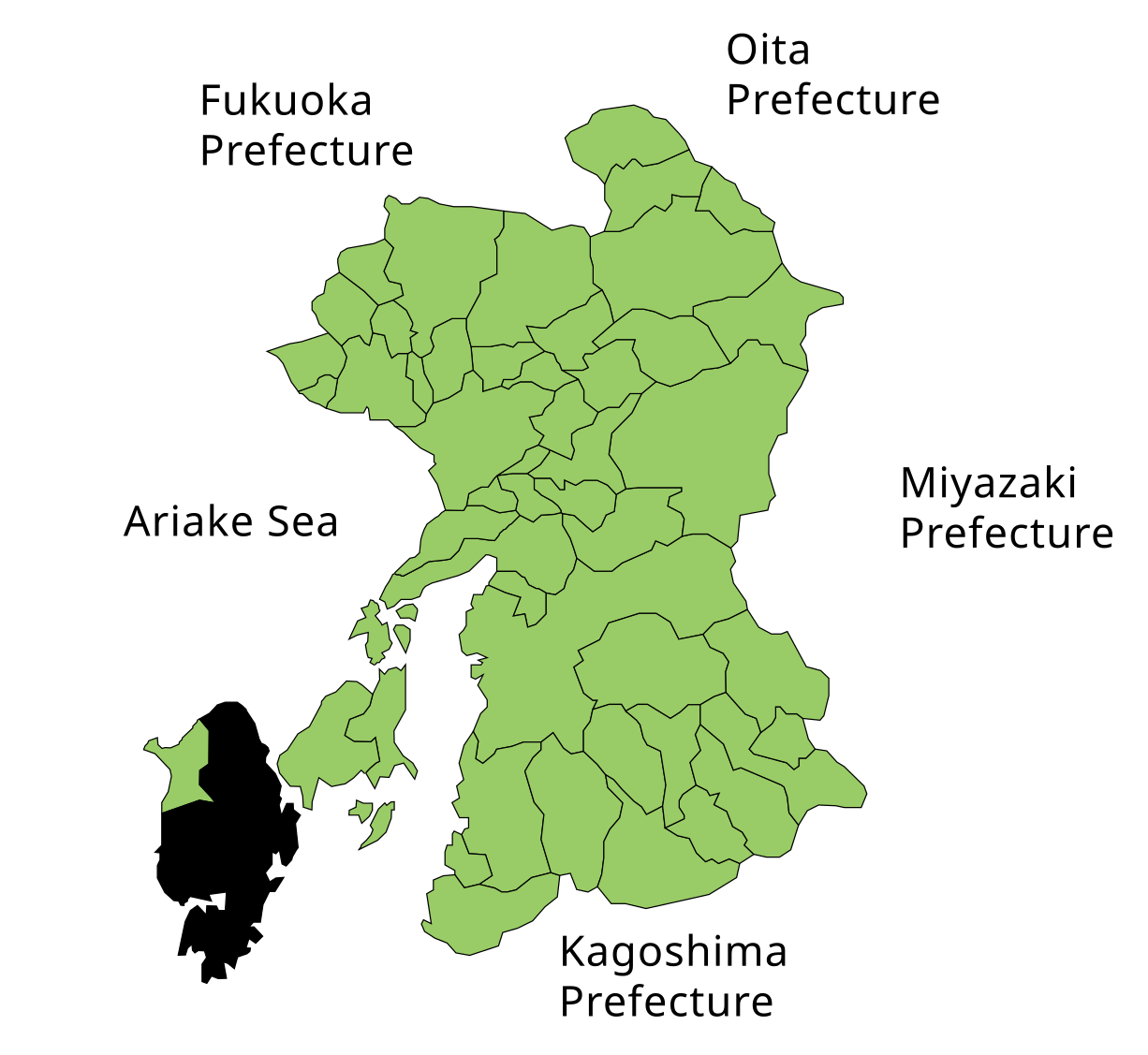
| Description | Map of Kumamoto prefecture |
| Date | |
| Source | SVG verion of Image:Map Amakusa en.png |
| Author | Mats Halldin |
| Permission (Reusing this file) |
PD-self |
| Other versions | As above |
Licensing[edit]
| I, the copyright holder of this work, release this work into the public domain. This applies worldwide. In some countries this may not be legally possible; if so: I grant anyone the right to use this work for any purpose, without any conditions, unless such conditions are required by law. |
File history
Click on a date/time to view the file as it appeared at that time.
| Date/Time | Thumbnail | Dimensions | User | Comment | |
|---|---|---|---|---|---|
| current | 07:33, 18 December 2006 | | 1,226 × 1,126 (50 KB) | Mats Halldin~commonswiki (talk | contribs) | {{Information |Description=Map of Kumamoto prefecture |Source=SVG verion of Image:Map Amakusa en.png |Date=dec 18, 2006 |Author=~~~ |Permission=PD-self |other_versions=As above }} Category:Maps of Kumamoto prefecture Category:Maps in English |
You cannot overwrite this file.
File usage on Commons
There are no pages that use this file.