File:Map Anatolia ancient regions-el.svg
Jump to navigation
Jump to search

Size of this PNG preview of this SVG file: 800 × 518 pixels. Other resolutions: 320 × 207 pixels | 640 × 414 pixels | 1,024 × 663 pixels | 1,280 × 828 pixels | 2,560 × 1,657 pixels | 921 × 596 pixels.
Original file (SVG file, nominally 921 × 596 pixels, file size: 278 KB)
Captions
Captions
Add a one-line explanation of what this file represents
| Description |
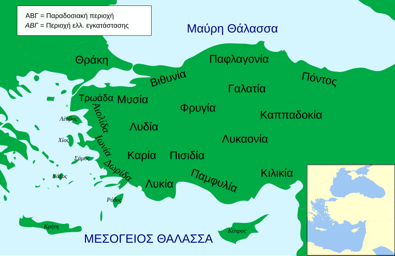
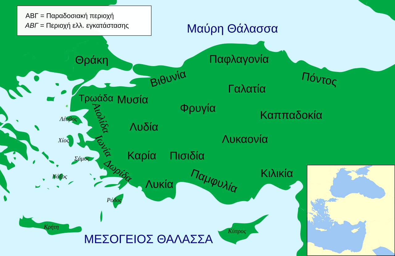
English: Political map of Asia Minor in 500 BC |
| Date | (UTC) |
| Source | |
| Author |
|
| Other versions |
[]
|


.svg)


| This is a retouched picture, which means that it has been digitally altered from its original version. Modifications: Greek Translation. The original can be viewed here: Anatolia Ancient Regions base.svg:
|
I, the copyright holder of this work, hereby publish it under the following licenses:
This file is licensed under the Creative Commons Attribution-Share Alike 3.0 Unported license.
- You are free:
- to share – to copy, distribute and transmit the work
- to remix – to adapt the work
- Under the following conditions:
- attribution – You must give appropriate credit, provide a link to the license, and indicate if changes were made. You may do so in any reasonable manner, but not in any way that suggests the licensor endorses you or your use.
- share alike – If you remix, transform, or build upon the material, you must distribute your contributions under the same or compatible license as the original.

|
Permission is granted to copy, distribute and/or modify this document under the terms of the GNU Free Documentation License, Version 1.2 or any later version published by the Free Software Foundation; with no Invariant Sections, no Front-Cover Texts, and no Back-Cover Texts. A copy of the license is included in the section entitled GNU Free Documentation License. |
You may select the license of your choice.
Original upload log[edit]
This image is a derivative work of the following images:
- File:Anatolia_Ancient_Regions_base.svg licensed with Cc-by-sa-3.0, GFDL
- 2009-04-23T19:48:50Z MinisterForBadTimes 921x596 (284616 Bytes) Added Galatia, minor other changes
- 2009-04-22T16:01:10Z MinisterForBadTimes 921x596 (283715 Bytes) {{Information |Description={{en|1= Political map of Asia Minor in 500 BC}} |Source=*[[:File:Asia_Minor_Political_500BC.svg|]] |Date=2009-04-22 17:00 (UTC) |Author=*[[:File:Asia_Minor_Political_500BC.svg|]]: *[[:File:Mysia.svg
Uploaded with derivativeFX
File history
Click on a date/time to view the file as it appeared at that time.
| Date/Time | Thumbnail | Dimensions | User | Comment | |
|---|---|---|---|---|---|
| current | 18:10, 15 February 2010 | | 921 × 596 (278 KB) | Egmontaz (talk | contribs) | {{Information |Description={{en|1= Political map of Asia Minor in 500 BC}} |Source=*File:Anatolia_Ancient_Regions_base.svg |Date=2010-02-15 18:08 (UTC) |Author=*File:Anatolia_Ancient_Regions_base.svg: *[[:File:Asia_Minor_Political_500BC.svg|As |
You cannot overwrite this file.
File usage on Commons
The following 21 pages use this file:
- File:AnatoliaAncientRegions.png
- File:Anatolia Ancient Regions ID.png
- File:Anatolia Ancient Regions base-el.svg (file redirect)
- File:Anatolia Ancient Regions base - el.svg (file redirect)
- File:Map Anatolia ancient regions-af.jpg
- File:Map Anatolia ancient regions-el.svg
- File:Map Anatolia ancient regions-en.svg
- File:Map Anatolia ancient regions-es.svg
- File:Map Anatolia ancient regions-hu.svg
- File:Map Anatolia ancient regions-it.svg
- File:Map Anatolia ancient regions-mk.svg
- File:Map Anatolia ancient regions-pt.svg
- File:Map Anatolia ancient regions-ru.png
- File:Map Anatolia ancient regions-ru.svg
- File:Map Anatolia ancient regions-sl.svg
- File:Map Anatolia ancient regions-tr.svg
- File:Map Anatolia ancient regions-uk.svg
- File:Map Anatolia ancient regions-zh.svg
- File:Map Anatolia ancient regions (Indonesian version).svg
- File:مناطق آناتولی باستان.svg
- Template:Other versions/Map Anatolia ancient regions
File usage on other wikis
The following other wikis use this file:
- Usage on el.wikipedia.org