File:Map of California highlighting Modoc County.svg
Jump to navigation
Jump to search

Size of this PNG preview of this SVG file: 512 × 587 pixels. Other resolutions: 209 × 240 pixels | 419 × 480 pixels | 670 × 768 pixels | 893 × 1,024 pixels | 1,786 × 2,048 pixels.
Original file (SVG file, nominally 512 × 587 pixels, file size: 224 KB)
Captions
Captions
Add a one-line explanation of what this file represents
Summary[edit]
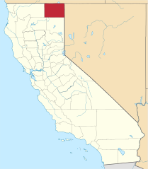
David Benbennick made this map.
For more information, see Commons:United States county locator maps.
| I, the copyright holder of this work, release this work into the public domain. This applies worldwide. In some countries this may not be legally possible; if so: I grant anyone the right to use this work for any purpose, without any conditions, unless such conditions are required by law. |
File history
Click on a date/time to view the file as it appeared at that time.
| Date/Time | Thumbnail | Dimensions | User | Comment | |
|---|---|---|---|---|---|
| current | 19:30, 2 September 2019 | | 512 × 587 (224 KB) | Fluffy89502 (talk | contribs) | newer version |
| 10:26, 12 February 2006 |  | 9,164 × 10,536 (229 KB) | David Benbennick (talk | contribs) | {{subst:User:Dbenbenn/clm|county=Modoc County|state=California}} |
You cannot overwrite this file.
File usage on Commons
The following 6 pages use this file:
File usage on other wikis
The following other wikis use this file:
- Usage on ar.wikipedia.org
- Usage on arz.wikipedia.org
- Usage on az.wikipedia.org
- Usage on ban.wikipedia.org
- Usage on bpy.wikipedia.org
- Usage on ca.wikipedia.org
- Usage on ceb.wikipedia.org
- Usage on ce.wikipedia.org
- Usage on cs.wikipedia.org
- Usage on cy.wikipedia.org
- Usage on da.wikipedia.org
- Usage on de.wikipedia.org
- Usage on en.wikipedia.org
- List of counties in California
- Modoc County, California
- Alturas, California
- Cedarville, California
- Adin, California
- Canby, California
- Template:Modoc County, California
- Fort Bidwell, California
- Davis Creek, California
- Tionesta, California
- Newell, California
- Crane Creek Lumber Company
- Alturas Indian Rancheria
- Category:Wikipedia requested photographs in Modoc County, California
- Eagleville, Modoc County, California
- Likely, California
- National Register of Historic Places listings in Modoc County, California
- User:Nyttend/County templates/CA/2
- New Pine Creek, California
- California Pines, California
View more global usage of this file.